
IMAGES TAKEN NEAR TO
Top Fold, KNOTTINGLEY, WF11 9JD
Introduction
This page details the photographs taken nearby to Top Fold, WF11 9JD by members of the Geograph project.
The Geograph project started in 2005 with the aim of publishing, organising and preserving representative images for every square kilometre of Great Britain, Ireland and the Isle of Man.

There are currently over 7.5m images from over14,400 individuals and you can help contribute to the project by visiting https://www.geograph.org.uk
Image Map
Images are licensed for reuse under creativecommons.org/licenses/by-sa/2.0
Notes
- Clicking on the map will re-center to the selected point.
- The higher the marker number, the further away the image location is from the centre of the postcode.
Image Listing (96 Images Found)
Images are licensed for reuse under creativecommons.org/licenses/by-sa/2.0
Image
Details
Distance
1

Top Fold
Top Fold and a footpath leading to North Road.
Image: © DS Pugh
Taken: 18 Mar 2023
0.01 miles

3

Fairburn Village viewed from Fryston Woods
The sunlight reflects off the houses in Fairburn on a snowy winters day.
Image: © derek dye
Taken: 22 Jan 2013
0.04 miles


6

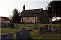
St. James Church
St. James Church from Silver Street, Fairburn.
Image: © Darren Haddock
Taken: 24 Oct 2006
0.05 miles
7

Fairburn, St James church
According to the OS benchmark database there was a benchmark cut into the south-east facing wall. The lower stone work is quite worn and weathered and nothing was found.
Image: © Mel Towler
Taken: 17 Jun 2022
0.05 miles
9

Purple and white "Bluebells"
Someone got the wrong dulux colour chart!
Image: © derek dye
Taken: 26 Apr 2005
0.05 miles
