IMAGES TAKEN NEAR TO
Parliament Row, WF11 9FG
Introduction
This page details the photographs taken nearby to Parliament Row, WF11 9FG by members of the Geograph project.
The Geograph project started in 2005 with the aim of publishing, organising and preserving representative images for every square kilometre of Great Britain, Ireland and the Isle of Man.

There are currently over 7.5m images from over14,400 individuals and you can help contribute to the project by visiting https://www.geograph.org.uk
Image Map
Images are licensed for reuse under creativecommons.org/licenses/by-sa/2.0
Notes
- Clicking on the map will re-center to the selected point.
- The higher the marker number, the further away the image location is from the centre of the postcode.
Image Listing (36 Images Found)
Images are licensed for reuse under creativecommons.org/licenses/by-sa/2.0
Image
Details
Distance
2
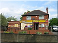
Two Clubhouses
Two clubhouses side by side. On the left, the Brotherton Amateur Rugby League Football Club Clubhouse and on the right, the Brotherton Flying Club. The flying club is not for aviators, but pigeon fliers!
Image: © Bill Henderson
Taken: 12 Sep 2007
0.06 miles
3
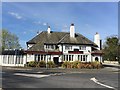
Thaal Indian Restaurant
Formerly the Brotherton Fox public house.
To the right of the pub is the A 1246Old Great North Road, (A1), to the left is a slip road off the A162 dual carriageway, which was previously the A1 until the A1(M) motorway was built a mile to the west.
Image: © Graham Hogg
Taken: 4 Apr 2017
0.07 miles
4
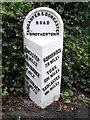
Old Milestone by the A162, Old Great North Road, Brotherton
Metal plate attached to stone post by the A162, in parish of BROTHERTON (SELBY District), Old Great North Road, Brotherton, North of Bryam Park Road, on pavement, on East side of road. Brayshaw & Booth iron casting, erected by the County Council in the 19th century.
Inscription reads:-
: DONCASTER / 16 MILES / FERRYBRIDGE 1 MILE / PONTEFRACT / 3¾ MILES : : TADCASTER & DONCASTER / ROAD / BROTHERTON : : BOROUGH BRIDGE / 28 MILES / YORK / 20¾ MILES / TADCASTER / 11¼ MILES :
Maker:-
: BRAYSHAW & BOOTH / MAKERS / LIVERSEDGE :
Grade II listed.
List Entry Number: 1167455 https://historicengland.org.uk/listing/the-list/list-entry/1167455
Milestone Society National ID: YN_DNTC16.
Image: © C Minto
Taken: 1 Jan 2002
0.09 miles
5
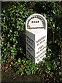
Old milestone
This West Riding CC milestone erected in 1893/94 was on the Great North Road which went through Brotherton. That became the A1. Now by-passed it is the A162 towards Tadcaster. If a name with more than 10 letters had to be cast on these attachments, all the names would be set at an angle. This milestone is well-cared for.
Image: © Chris Minto
Taken: 9 Jan 2022
0.09 miles
6
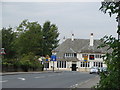
The Thaal Indian Restaurant
This is the former Brotherton Fox Hotel, a well known landmark on the Old Great North Road.
Image: © Bill Henderson
Taken: 12 Sep 2007
0.10 miles
7
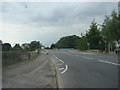
The bridge over the old A1 trunkroad
The A1 trunk road has now been diverted to the western side of Ferrybridge power station. The old A1 trunk road has become little more than a local access road.
Image: © Bill Henderson
Taken: 12 Sep 2007
0.13 miles
8
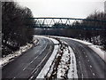
Footbridge over the A1246 at Brotherton
Prior to the construction of the Darrington to Hook Moor section of the A1M Motorway in 2006, this was the A1 dual carriageway. This road constructed about 1960 took the place of the "Great North Road".
Image: © derek dye
Taken: 23 Jan 2013
0.14 miles
9
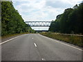
A footpath goes over the A1 at Botherton
This part of the A1 has been bypassed by the A1M
Image: © Ian S
Taken: 31 Jul 2011
0.14 miles