IMAGES TAKEN NEAR TO
Aire Street, KNOTTINGLEY, WF11 9AY
Introduction
This page details the photographs taken nearby to Aire Street, WF11 9AY by members of the Geograph project.
The Geograph project started in 2005 with the aim of publishing, organising and preserving representative images for every square kilometre of Great Britain, Ireland and the Isle of Man.

There are currently over 7.5m images from over14,400 individuals and you can help contribute to the project by visiting https://www.geograph.org.uk
Image Map
Images are licensed for reuse under creativecommons.org/licenses/by-sa/2.0
Notes
- Clicking on the map will re-center to the selected point.
- The higher the marker number, the further away the image location is from the centre of the postcode.
Image Listing (136 Images Found)
Images are licensed for reuse under creativecommons.org/licenses/by-sa/2.0
Image
Details
Distance

2

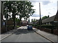
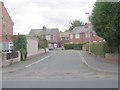
View from Aire Street of Ferrybridge Power Station
Image: © Betty Longbottom
Taken: 21 Mar 2009
0.04 miles

6
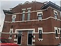
Knottingley Former Palace Cinema 1912
The Palace Cinema opened in 1912 by the Knottingley Picture Palace Company Limited, equipped with Western Electronics sound system. By 1954, it was owned by the Leeds based company Star Cinemas, fitting a full seating of 600 people, and operated until it's closure in December 1960 after surviving two world wars. The building has since been transformed and converted into flats, with the façade of the old cinema still somewhat intact. The Palance Cinema is now the only remnant of the old Aire Street left.
Image: © Belahzur
Taken: 16 Dec 2022
0.05 miles
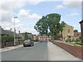
8
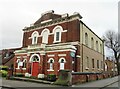
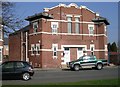
United Reformed Church, Knottingley
A curious building which seems out of character with the area around it, which is mostly mid to late 20th century housing. Old maps reveal that the chapel was here circa 1895 and at that time was at the 'back' of the main part of the town close by open fields and allotment gardens.
Image: © Gordon Hatton
Taken: 30 Dec 2021
0.05 miles
9

River Aire at Knottingley
The Aire at Knottingley once marked the highest navigable point on the river, and thus the little town developed as an inland port to serve the industrial towns and cities further west. The river was abandoned in 1826 upon the opening of the canal through to Goole. In the distance are two of the remaining three cooling towers at Ferrybridge Power Station.
Image: © Gordon Hatton
Taken: 30 Dec 2021
0.06 miles