
IMAGES TAKEN NEAR TO
Low Cross Court, KNOTTINGLEY, WF11 9AP
Introduction
This page details the photographs taken nearby to Low Cross Court, WF11 9AP by members of the Geograph project.
The Geograph project started in 2005 with the aim of publishing, organising and preserving representative images for every square kilometre of Great Britain, Ireland and the Isle of Man.

There are currently over 7.5m images from over14,400 individuals and you can help contribute to the project by visiting https://www.geograph.org.uk
Image Map
Images are licensed for reuse under creativecommons.org/licenses/by-sa/2.0
Notes
- Clicking on the map will re-center to the selected point.
- The higher the marker number, the further away the image location is from the centre of the postcode.
Image Listing (189 Images Found)
Images are licensed for reuse under creativecommons.org/licenses/by-sa/2.0
Image
Details
Distance
2
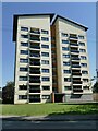
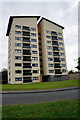
Low Cross Court
A 1960s block of flats (the UK Housing Wiki says that it was approved in 1966), but looks to have been refurbished more recently.
Image: © Stephen Craven
Taken: 13 Aug 2022
0.01 miles
3

St Botolph's parish rooms
Situated south of the church in its own grounds distinct from the churchyard.
Image: © Stephen Craven
Taken: 13 Aug 2022
0.03 miles
5
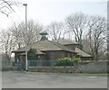
St Botolph's Parish Room - Chapel Street
Image: © Betty Longbottom
Taken: 21 Mar 2009
0.04 miles
6

Knottingley - The United Reformed Church
Image: © Bill Henderson
Taken: 24 Aug 2006
0.04 miles
8
Holly House
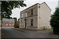
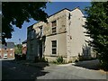
Set opposite Knottingley parish church, this early 19th century house forms the front of an L-shaped courtyard, another part of which is shown on the 1907 map as a school. It is listed grade II (list entry 1266187) although older looking properties in the same town are not. When listed in 1987 it was described as a library, but it is obviously no longer in use as such.
Image: © Stephen Craven
Taken: 13 Aug 2022
0.04 miles
9
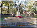
Knottingley Cenotaph, November 2005
Knottingley Cenotaph is located in Chapel Street, just off Weeland Road, Knottingley. It is adjacent to the grounds of St Botolph's Anglican Parish Church and near Knottingley Town Hall. St Botolph's Parish Hall is in the background.
Image: © Robert Neilson
Taken: 13 Nov 2005
0.04 miles
10
The Croft - viewed from Chapel Street
Image: © Betty Longbottom
Taken: 27 Aug 2010
0.04 miles