
IMAGES TAKEN NEAR TO
Kirkhaw Lane, KNOTTINGLEY, WF11 8RD
Introduction
This page details the photographs taken nearby to Kirkhaw Lane, WF11 8RD by members of the Geograph project.
The Geograph project started in 2005 with the aim of publishing, organising and preserving representative images for every square kilometre of Great Britain, Ireland and the Isle of Man.

There are currently over 7.5m images from over14,400 individuals and you can help contribute to the project by visiting https://www.geograph.org.uk
Image Map
Images are licensed for reuse under creativecommons.org/licenses/by-sa/2.0
Notes
- Clicking on the map will re-center to the selected point.
- The higher the marker number, the further away the image location is from the centre of the postcode.
Image Listing (190 Images Found)
Images are licensed for reuse under creativecommons.org/licenses/by-sa/2.0
Image
Details
Distance
1
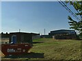
Sewage works off Kirkhaw Lane
The brick structure to the right is shown as a sewage works of Pontefract Urban District Council on the 1907 map. Amazingly it's still here, though presumably not in use as the one to the left (behind the skip) is a sewage pumping station Image
Image: © Stephen Craven
Taken: 13 Aug 2022
0.03 miles
2
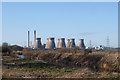
Ferrybridge"C" power station (disused) and the river Aire
Image: © derek dye
Taken: 28 Jan 2019
0.03 miles
3
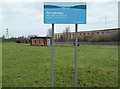
Ferrybridge Waste Water Pumping Station
Alongside the massive Ferrybridge C Power Station. The big building in the background is the former Ferrybridge A Power Station that is now a training centre. The B station was demolished in the 1990s.
Image: © Chris Allen
Taken: 25 Nov 2012
0.04 miles
4
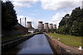
One down, seven to go.
A gap, a couple of days after one of the eight cooling towers at Ferrybridge power station had been demolished
Image: © derek dye
Taken: 15 Aug 2019
0.04 miles
5
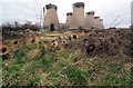
Lost power
Disused farm equipment with a backcloth of Ferrybridge power station cooling towers.
Image: © Steve Fareham
Taken: 26 Jan 2008
0.05 miles
6
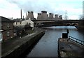
Power Station,Canal and River at Ferrybridge
Image: © derek dye
Taken: 13 Feb 2012
0.06 miles
7
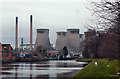
Ferrybridge power station from canal
The closed power station looks down on the Knottingley to Goole canal at Ferrybridge.
Image: © derek dye
Taken: 8 Feb 2018
0.07 miles
8
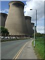
Cooling Towers of Ferrybridge B
The Cooling Towers of Ferrybridge B power station in Ferrybridge from Kirkhaw Lane
Image: © Simon Dean
Taken: 2 Sep 2008
0.07 miles
9
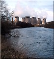
The River Aire and Ferrybridge Power Station
Looking upstream towards Ferrybridge from the Kings Mill at Knottingley
Image: © derek dye
Taken: 13 Feb 2012
0.07 miles
10
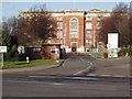
Ferrybridge Engineering Workshops
The former Ferrybridge "A" Power Station when it closed was converted into regional engineering workshops by the C.E.G.B. With the privatisation of electricity generation, the workshops are now part of RWE.
Image: © Robert Neilson
Taken: 3 Dec 2006
0.08 miles