
IMAGES TAKEN NEAR TO
Pontefract Road, KNOTTINGLEY, WF11 8PS
Introduction
This page details the photographs taken nearby to Pontefract Road, WF11 8PS by members of the Geograph project.
The Geograph project started in 2005 with the aim of publishing, organising and preserving representative images for every square kilometre of Great Britain, Ireland and the Isle of Man.

There are currently over 7.5m images from over14,400 individuals and you can help contribute to the project by visiting https://www.geograph.org.uk
Image Map
Images are licensed for reuse under creativecommons.org/licenses/by-sa/2.0
Notes
- Clicking on the map will re-center to the selected point.
- The higher the marker number, the further away the image location is from the centre of the postcode.
Image Listing (28 Images Found)
Images are licensed for reuse under creativecommons.org/licenses/by-sa/2.0
Image
Details
Distance
1
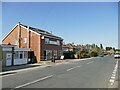
Fish and chip shop, Pontefract Road, Ferrybridge
Image: © Stephen Craven
Taken: 13 Aug 2022
0.07 miles
2

Windsor drive Ferrybridge
Overlooked by the silent giants of the redundant power station.
Image: © derek dye
Taken: 15 Jan 2018
0.08 miles
3
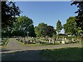
East side of Ferrybridge Cemetery
The cemetery is on Pontefract Road.
Image: © Stephen Craven
Taken: 13 Aug 2022
0.09 miles
5

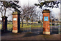
Ferrybridge
View from Kingsley Avenue to houses on Pontefract Road in the shadow of cooling towers of Ferrybridge Power Station
Image: © Richard Croft
Taken: 28 Feb 2013
0.13 miles
6
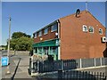
Convenience store, Pontefract Road, Ferrybridge
Image: © Stephen Craven
Taken: 13 Aug 2022
0.13 miles
7
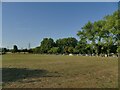
Ferrybridge Cemetery extension
The original small cemetery on Pontefract Road has been expanded with a larger plot to the west which has space for many decades to come.
Image: © Stephen Craven
Taken: 13 Aug 2022
0.14 miles
9
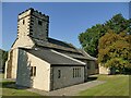
St Andrew's, Ferrybridge - south side
The church of St Andrew, Ferry Fryston was of Norman origin but rebuilt in 1350 and restored and extended in 1879. Subject to frequent flooding (being near the river Aire) and then the building of a power station nearby, it was deconstructed in 1952 and rebuilt (as St Andrew, Ferrybridge) on its present site in 1954 with two new bells in the tower. Listed grade II (list entry 1265111). There is a more recent extension to the south-west. There are no burials in the churchyard, as the original churchyard continued in use until 1986 Image and there is now a civic cemetery nearby.
Image: © Stephen Craven
Taken: 13 Aug 2022
0.15 miles
10
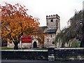
St Andrews church Ferrybridge
This church was dismantled from its original site in the mid 50's and rebuilt here because of continual flooding and to make way for Ferrybridge "C" power station, half a mile away.
Image: © derek dye
Taken: 15 Nov 2016
0.15 miles