
IMAGES TAKEN NEAR TO
Pontefract Road, KNOTTINGLEY, WF11 8PL
Introduction
This page details the photographs taken nearby to Pontefract Road, WF11 8PL by members of the Geograph project.
The Geograph project started in 2005 with the aim of publishing, organising and preserving representative images for every square kilometre of Great Britain, Ireland and the Isle of Man.

There are currently over 7.5m images from over14,400 individuals and you can help contribute to the project by visiting https://www.geograph.org.uk
Image Map
Images are licensed for reuse under creativecommons.org/licenses/by-sa/2.0
Notes
- Clicking on the map will re-center to the selected point.
- The higher the marker number, the further away the image location is from the centre of the postcode.
Image Listing (224 Images Found)
Images are licensed for reuse under creativecommons.org/licenses/by-sa/2.0
Image
Details
Distance
1

Railway bridge over Pontefract Road, Ferrybridge
This looks to be a modern rebuild, concrete with brick facing, but retaining the arched form, and 12ft 8in height limit, of the original. Image shows the other side. Ferrybridge station was to the right of the bridge but closed in 1965.
Image: © Stephen Craven
Taken: 13 Aug 2022
0.01 miles
2

Railway bridge Pontefract Road Ferrybridge
Image: © derek dye
Taken: 12 Mar 2013
0.02 miles
3

Ferrybridge: bridge on Pontefract Road under main lines at site of former station, 1995
View westward, under the main Swinton & Knottingley (ex-Midland & NE Joint) line from York via Church Fenton (to the right) to Pontefract and Sheffield (to the left). The station, which was up to the left, was purely for local purposes, being close to Pontefract and Knottingley, was closed 13/9/65, but the lines remain on busy routes. (Cf. Image], which shows interesting changes since 1995.)
Image: © Ben Brooksbank
Taken: 28 Apr 1995
0.02 miles

5

Ferrybridge Signals substation
The installation is at the start of what was the railway station approach road, and now leads to a small industrial estate.
Image: © Stephen Craven
Taken: 13 Aug 2022
0.02 miles
6

St Andrews Church Ferrybridge
The church was moved (dismantled and rebuilt) in the 1950's. It used to stand in marshy land at the side of the power station cooling towers. The graveyard still remains in situ. See supplementary photo http://www.geograph.org.uk/photo/2128236. Not sure if the bodies have been removed or still there?
Image: © derek dye
Taken: 17 Sep 2010
0.04 miles
7

Former school house, Pontefract Road, Ferrybridge
I presume this building next to an old school Image was the schoolmaster's house originally.
Image: © Stephen Craven
Taken: 13 Aug 2022
0.04 miles
8

Mission Room allotments, Ferrybridge
The original mission room on Pontefract Road is long gone but the name lives on in these allotments behind its site.
Image: © Stephen Craven
Taken: 13 Aug 2022
0.04 miles
9

Former school, Pontefract Road, Ferrybridge
Now part of a business park.
Image: © Stephen Craven
Taken: 13 Aug 2022
0.05 miles
10
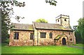
Ferrybridge, St Andrew's Church
This Church used to occupy a site on what is now Ferrybridge Power station. It was demolished and re-built on its present site on Pontefract Road, Ferrybridge in 1952.
Image: © Bill Henderson
Taken: Unknown
0.06 miles