
IMAGES TAKEN NEAR TO
The Nurseries, KNOTTINGLEY, WF11 8LN
Introduction
This page details the photographs taken nearby to The Nurseries, WF11 8LN by members of the Geograph project.
The Geograph project started in 2005 with the aim of publishing, organising and preserving representative images for every square kilometre of Great Britain, Ireland and the Isle of Man.

There are currently over 7.5m images from over14,400 individuals and you can help contribute to the project by visiting https://www.geograph.org.uk
Image Map
Images are licensed for reuse under creativecommons.org/licenses/by-sa/2.0
Notes
- Clicking on the map will re-center to the selected point.
- The higher the marker number, the further away the image location is from the centre of the postcode.
Image Listing (26 Images Found)
Images are licensed for reuse under creativecommons.org/licenses/by-sa/2.0
Image
Details
Distance
2
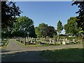
East side of Ferrybridge Cemetery
The cemetery is on Pontefract Road.
Image: © Stephen Craven
Taken: 13 Aug 2022
0.04 miles
3
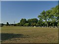
Ferrybridge Cemetery extension
The original small cemetery on Pontefract Road has been expanded with a larger plot to the west which has space for many decades to come.
Image: © Stephen Craven
Taken: 13 Aug 2022
0.05 miles
5
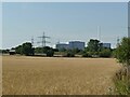
View towards the new Ferrybridge power station
All the iconic cooling towers of the earlier coal-fired power stations have been demolished, the last of them less than a year earlier. In their place is SSE's smaller 'multi fuel' power station generating up to 70MW from burning domestic refuse, industrial and commercial waste, and waste wood products. It started generating in 2015 and was fully operational by December 2019.
Image: © Stephen Craven
Taken: 13 Aug 2022
0.07 miles
6

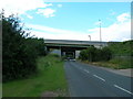
Motorway bridges over Pontefract Road
Junction 41 of the M62 where it meets the A1(M) is a complex one. The nearest bridge is the slip road from the M62 eastbound to A1(M) southbound; then the A1(M) main carriageway; finally the M62 main carriageway which at this point runs roughly north/south.
Image: © Stephen Craven
Taken: 13 Aug 2022
0.09 miles

8

Three motorway Bridges Pontefract
Pontefract road between Nevison and Ferrybridge passes beneath three bridges carrying the M62 and A1M Motorways and link road.
Image: © derek dye
Taken: 2 Dec 2012
0.13 miles
9
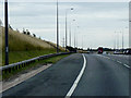
Joining Southbound A1M at Holmfield Interchange
Holmfield Interchange is junction 32A of the M62 and junction 41 of the A1(M) near to Ferrybridge Power Station. It was built in 2005 to partially replace the 3 stacked roundabout Ferrybridge Interchange at Junction 33 (http://www.sabre-roads.org.uk/wiki/index.php?title=Holmfield_Interchange SABRE).
Image: © David Dixon
Taken: 2 Aug 2015
0.15 miles
10
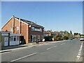
Fish and chip shop, Pontefract Road, Ferrybridge
Image: © Stephen Craven
Taken: 13 Aug 2022
0.17 miles