
IMAGES TAKEN NEAR TO
Glebelands, KNOTTINGLEY, WF11 8DS
Introduction
This page details the photographs taken nearby to Glebelands, WF11 8DS by members of the Geograph project.
The Geograph project started in 2005 with the aim of publishing, organising and preserving representative images for every square kilometre of Great Britain, Ireland and the Isle of Man.

There are currently over 7.5m images from over14,400 individuals and you can help contribute to the project by visiting https://www.geograph.org.uk
Image Map
Images are licensed for reuse under creativecommons.org/licenses/by-sa/2.0
Notes
- Clicking on the map will re-center to the selected point.
- The higher the marker number, the further away the image location is from the centre of the postcode.
Image Listing (25 Images Found)
Images are licensed for reuse under creativecommons.org/licenses/by-sa/2.0
Image
Details
Distance
1
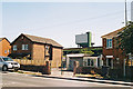
A colliery in the back garden
Kellingley does not have the appearance of a typical colliery village, but the winding towers are an ever present reminder.
Image: © Alan Murray-Rust
Taken: Unknown
0.06 miles
2

Kellingley Colliery
Kellingley Colliery (Big "K") viewed from footpath at side of river Aire. The colliery is earmarked for closure next year.
Image: © derek dye
Taken: 10 Jun 2014
0.08 miles
3
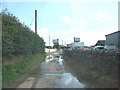
Kellingley Village Street , with Kellingley Colliery in view.
Image: © Bill Henderson
Taken: 19 Sep 2006
0.10 miles
4

Kellingley Colliery
Taken from Kellingley Crook.
Image: © Ian S
Taken: 7 Aug 2014
0.11 miles
5
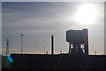
Two years on
Two years to the day that the last deep mine in the country closed.
Image: © derek dye
Taken: 17 Dec 2017
0.12 miles
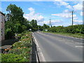
7
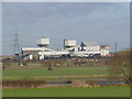
Kellingley Colliery
One of the last three operating deep pits in the UK at the time the picture was taken.
Image: © Alan Murray-Rust
Taken: 24 Dec 2013
0.14 miles

9

Sunset over Kellingley Colliery
Seen from Eggborough one can just discern Kellingley Colliery and Ferrybridge Power Station on the horizon. Ferrybridge is between the two pylons on the right. Kellingley is just left of the largest skeletal tree. Both sites are to be demolished.
Image: © Chris Allen
Taken: 4 Nov 2017
0.15 miles
10

Kellingley Colliery
One of the last working deep mines. The two tower winders are clearly visible with the letter K on top. Part of the washery is seen in front of the left hand winder. The left hand shaft is the upcast and the right is the downcast (confirmed by Ashley Dace).
Image: © Chris Allen
Taken: 10 Nov 2013
0.15 miles