
IMAGES TAKEN NEAR TO
Turvers Lane, KNOTTINGLEY, WF11 8DP
Introduction
This page details the photographs taken nearby to Turvers Lane, WF11 8DP by members of the Geograph project.
The Geograph project started in 2005 with the aim of publishing, organising and preserving representative images for every square kilometre of Great Britain, Ireland and the Isle of Man.

There are currently over 7.5m images from over14,400 individuals and you can help contribute to the project by visiting https://www.geograph.org.uk
Image Map
Images are licensed for reuse under creativecommons.org/licenses/by-sa/2.0
Notes
- Clicking on the map will re-center to the selected point.
- The higher the marker number, the further away the image location is from the centre of the postcode.
Image Listing (34 Images Found)
Images are licensed for reuse under creativecommons.org/licenses/by-sa/2.0
Image
Details
Distance


4

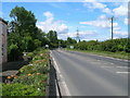
Kellingley Colliery
Kellingley Colliery (Big "K") viewed from footpath at side of river Aire. The colliery is earmarked for closure next year.
Image: © derek dye
Taken: 10 Jun 2014
0.12 miles
5
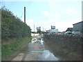
Kellingley Village Street , with Kellingley Colliery in view.
Image: © Bill Henderson
Taken: 19 Sep 2006
0.12 miles
6

Kellingley Colliery
Taken from Kellingley Crook.
Image: © Ian S
Taken: 7 Aug 2014
0.13 miles
7
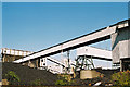
Kellingley Colliery
Conveyor bridges and bunkers seen from the Aire and Calder Navigation.
Image: © Alan Murray-Rust
Taken: Unknown
0.13 miles
8
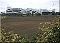
Kellingley Colliery
Looking northeast from the level crossing on Common Lane. Known to miners as 'The Big K', Kellingley Colliery started with the sinking of shafts in 1958 with the first coal being produced in 1965. RJB Mining took over operations at Kellingley in January 1995 and since then it has continued to work the 650 metre deep Silkstone and 700 metre deep Beeston seams. It is estimated that a further 18 million tonnes of coal could also be extracted from the nearby Warren House seam in the future.
Image: © Paul Glazzard
Taken: 8 Oct 2007
0.14 miles
9
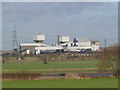
Kellingley Colliery
One of the last three operating deep pits in the UK at the time the picture was taken.
Image: © Alan Murray-Rust
Taken: 24 Dec 2013
0.14 miles
10
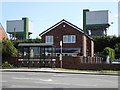
Kellingley across the A645
This view is surely threatened as the colliery ceased production in December 2015.
Image: © Chris Allen
Taken: 7 Aug 2016
0.15 miles