IMAGES TAKEN NEAR TO
Weeland Road, KNOTTINGLEY, WF11 8AQ
Introduction
This page details the photographs taken nearby to Weeland Road, WF11 8AQ by members of the Geograph project.
The Geograph project started in 2005 with the aim of publishing, organising and preserving representative images for every square kilometre of Great Britain, Ireland and the Isle of Man.

There are currently over 7.5m images from over14,400 individuals and you can help contribute to the project by visiting https://www.geograph.org.uk
Image Map
Images are licensed for reuse under creativecommons.org/licenses/by-sa/2.0
Notes
- Clicking on the map will re-center to the selected point.
- The higher the marker number, the further away the image location is from the centre of the postcode.
Image Listing (200 Images Found)
Images are licensed for reuse under creativecommons.org/licenses/by-sa/2.0
Image
Details
Distance
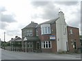
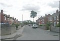
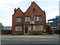
1
Knottingley Police Station, Weeland Road, Knottingley
Image: © Bill Henderson
Taken: 18 Sep 2006
0.01 miles
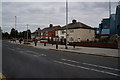
2
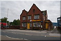
Jklbikes.com on Weeland Road, Knottingley
The former Knottingley Police Station.
Image: © Ian S
Taken: 7 Aug 2014
0.01 miles
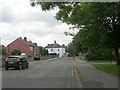
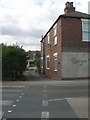
7
The co-operative funeralcare - Weeland Road
Image: © Betty Longbottom
Taken: 27 Aug 2010
0.05 miles
8
Banks Garth Cottages - Weeland Road
Image: © Betty Longbottom
Taken: 27 Aug 2010
0.05 miles
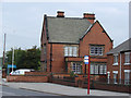
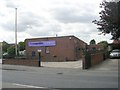
9
Former Police Station - Weeland Road
Image: © Betty Longbottom
Taken: 27 Aug 2010
0.06 miles