
IMAGES TAKEN NEAR TO
Parklands, CASTLEFORD, WF10 4HR
Introduction
This page details the photographs taken nearby to Parklands, WF10 4HR by members of the Geograph project.
The Geograph project started in 2005 with the aim of publishing, organising and preserving representative images for every square kilometre of Great Britain, Ireland and the Isle of Man.

There are currently over 7.5m images from over14,400 individuals and you can help contribute to the project by visiting https://www.geograph.org.uk
Image Map
Images are licensed for reuse under creativecommons.org/licenses/by-sa/2.0
Notes
- Clicking on the map will re-center to the selected point.
- The higher the marker number, the further away the image location is from the centre of the postcode.
Image Listing (68 Images Found)
Images are licensed for reuse under creativecommons.org/licenses/by-sa/2.0
Image
Details
Distance
1
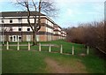
Parklands
Three-storey 1960s flats, as near (thankfully) as it gets to high-rise in Castleford. The overgrown hedgerows on the right are the edge of Smawthorne Swamps.
Image: © David Pickersgill
Taken: 27 Jan 2008
0.01 miles
2
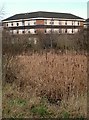
Smawthorne Swamps 1
Most of this area was originally allotments but subsidence made the land gradually wetter until all were abandoned by the end of the 1970s. Now it is a valuable urban nature reserve, a mix of impenetrable undergrowth, reedbeds and standing water, largely undisturbed by humans, with just a couple of paths through it.
Image: © David Pickersgill
Taken: 27 Jan 2008
0.02 miles
3
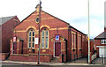
The Gospel Hall, Formerly Pontefract Road Primitive Methodist Church
Image: © Bill Henderson
Taken: Unknown
0.08 miles
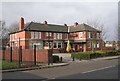
5

Castleford Carpet Depot - Pontefract Road
Image: © Betty Longbottom
Taken: 18 Aug 2010
0.09 miles

7

Smawthorne Swamps 2
This view is typical of the higher, drier parts of this area, showing one of the paths which cuts through it.
Image: © David Pickersgill
Taken: 27 Jan 2008
0.11 miles

10
Pretoria Street - Smawthorne Lane
Image: © Betty Longbottom
Taken: 18 Aug 2010
0.13 miles