
IMAGES TAKEN NEAR TO
Hugh Street, CASTLEFORD, WF10 4DU
Introduction
This page details the photographs taken nearby to Hugh Street, WF10 4DU by members of the Geograph project.
The Geograph project started in 2005 with the aim of publishing, organising and preserving representative images for every square kilometre of Great Britain, Ireland and the Isle of Man.

There are currently over 7.5m images from over14,400 individuals and you can help contribute to the project by visiting https://www.geograph.org.uk
Image Map
Images are licensed for reuse under creativecommons.org/licenses/by-sa/2.0
Notes
- Clicking on the map will re-center to the selected point.
- The higher the marker number, the further away the image location is from the centre of the postcode.
Image Listing (268 Images Found)
Images are licensed for reuse under creativecommons.org/licenses/by-sa/2.0
Image
Details
Distance
1
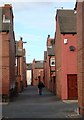
Smawthorne street scene 2
Un-named alley which cuts across the parallel streets of terraced houses: Hugh Street nearest the camera, then Glebe Street and finally Lower Oxford Street (where the cream-painted house in the farthest distance stands). Note how the front doors open directly on to the street.
Image: © David Pickersgill
Taken: 27 Jan 2008
0.03 miles


6
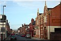
Vickers Street
Runs at right angles to streets of late 19th/early 20th century terrace housing. Former branch of Castleford Co-Operative Society on right, subsequently a warehouse and factory, sympathetically converted into flats in 2007. Vickers Street Working Men's Club beyond on same side of road.
Image: © David Pickersgill
Taken: 27 Jan 2008
0.05 miles


9

Smawthorne street scene 1
Back street between Hugh Street (houses on left) and Glebe Street (houses on right) in the Smawthorne area of Castleford. These and surrounding streets of 'two up, two down' red brick terraces were mainly built in the five years either side of 1900. The area was the subject of a renewal scheme in the early 1990s, with new roofs, windows, brick cleaning and repointing, new back yard walls and gates, plus pedestrian-friendly street resurfacing, to prolong the life of the houses in what is a very popular area to live.
Image: © David Pickersgill
Taken: 27 Jan 2008
0.06 miles
10
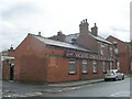
Vickers Street Social Club - Vickers Street
Image: © Betty Longbottom
Taken: 20 Aug 2010
0.07 miles