
IMAGES TAKEN NEAR TO
Aire Valley Mount, CASTLEFORD, WF10 3UB
Introduction
This page details the photographs taken nearby to Aire Valley Mount, WF10 3UB by members of the Geograph project.
The Geograph project started in 2005 with the aim of publishing, organising and preserving representative images for every square kilometre of Great Britain, Ireland and the Isle of Man.

There are currently over 7.5m images from over14,400 individuals and you can help contribute to the project by visiting https://www.geograph.org.uk
Image Map
Images are licensed for reuse under creativecommons.org/licenses/by-sa/2.0
Notes
- Clicking on the map will re-center to the selected point.
- The higher the marker number, the further away the image location is from the centre of the postcode.
Image Listing (53 Images Found)
Images are licensed for reuse under creativecommons.org/licenses/by-sa/2.0
Image
Details
Distance
1

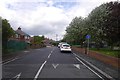
Water facilities, Red Hill
Covered reservoirs and a water tower on top of Castleford.
Image: © Richard Webb
Taken: 21 May 2016
0.04 miles
3
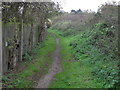
Pathway to Glasshoughton
This is on the pathway from Redhill to Glasshoughton
Image: © Bruce Thomas
Taken: 16 Oct 2011
0.05 miles
4
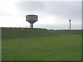
Water water
Water pumping station and Radio mast Redhill Castleford, Highest point in Castleford
Image: © Bruce Thomas
Taken: 16 Oct 2011
0.05 miles
5

Official graffiti - Redhill Road
Nag nag nag! Oh, that lot were from Sheffield. Never mind, if this stops the dreaded extra loop to clear your tyre or soft footstep, I'm all for it.
Image: © Richard Webb
Taken: 21 May 2016
0.06 miles
6
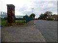
Red Hill
Summit appears to be on Redhill Rd, just past gates to reservoir compound and junction with West Mead. Man made things inside reservoir compound obviously higher.
Name: Red Hill
Hill number: 16857
Height: 75m / 246ft
Parent (Ma/M): 2810 Black Hill
Section: 36: Lancashire, Cheshire & the Southern Pennines
County/UA: Wakefield (UA)
Class: Tump (0-99m)
Grid ref: SE 44221 25214
Summit feature: no feature: ground near entrance to reservoir compound
Drop: 48m
Col: 27m SE430236
Image: © Rude Health
Taken: 2 May 2015
0.06 miles
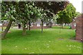
8
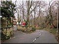
Redhill Road, Castleford
Image: © Derek Harper
Taken: 5 Jan 2014
0.09 miles
9
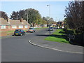
Entrance to West Mead
Westmead bungalows
Image: © Bruce Thomas
Taken: 20 Oct 2011
0.09 miles
10
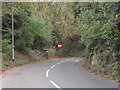
Old road
This is the Old Redhill road looking towards Castleford, before the new road was built in 1947, this was the only way to get to Redhill
Image: © Bruce Thomas
Taken: 16 Oct 2011
0.10 miles