
IMAGES TAKEN NEAR TO
Calder Close, CASTLEFORD, WF10 3DH
Introduction
This page details the photographs taken nearby to Calder Close, WF10 3DH by members of the Geograph project.
The Geograph project started in 2005 with the aim of publishing, organising and preserving representative images for every square kilometre of Great Britain, Ireland and the Isle of Man.

There are currently over 7.5m images from over14,400 individuals and you can help contribute to the project by visiting https://www.geograph.org.uk
Image Map
Images are licensed for reuse under creativecommons.org/licenses/by-sa/2.0
Notes
- Clicking on the map will re-center to the selected point.
- The higher the marker number, the further away the image location is from the centre of the postcode.
Image Listing (6 Images Found)
Images are licensed for reuse under creativecommons.org/licenses/by-sa/2.0
Image
Details
Distance
1

Humber Close off Stansfield Road, Castleford
Image: © Chris Heaton
Taken: 1 Aug 2025
0.07 miles
2
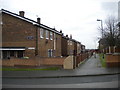
Foss Walk, Airedale
Off Stansfield Road, a later adjunct to Airedale estate.
Image: © Richard Vince
Taken: 28 Nov 2015
0.17 miles
3
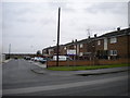
Backs of houses, Foss Walk, Airedale
These houses are provided with a capacious car park and set of garages (left), off Stansfield Road.
Image: © Richard Vince
Taken: 28 Nov 2015
0.18 miles
4
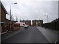
Car park and garages off Stansfield Road, Airedale
Providing vehicular access to several small groups of houses; the ones at the far end are on Wharfe Way, a sort of distributor footpath for this development.
Image: © Richard Vince
Taken: 28 Nov 2015
0.19 miles
5

Ruskin Drive, Castleford
Residential thoroughfare off Stansfield Road
Image: © Chris Heaton
Taken: 1 Aug 2025
0.22 miles
6
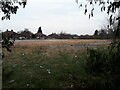
Site of the former Redhill primary school, Airedale
Demolished at some time since photographed in 2014 Image
Image: © Stephen Craven
Taken: 21 Mar 2022
0.22 miles