IMAGES TAKEN NEAR TO
Queens Park Drive, CASTLEFORD, WF10 3DG
Introduction
This page details the photographs taken nearby to Queens Park Drive, WF10 3DG by members of the Geograph project.
The Geograph project started in 2005 with the aim of publishing, organising and preserving representative images for every square kilometre of Great Britain, Ireland and the Isle of Man.

There are currently over 7.5m images from over14,400 individuals and you can help contribute to the project by visiting https://www.geograph.org.uk
Image Map
Images are licensed for reuse under creativecommons.org/licenses/by-sa/2.0
Notes
- Clicking on the map will re-center to the selected point.
- The higher the marker number, the further away the image location is from the centre of the postcode.
Image Listing (18 Images Found)
Images are licensed for reuse under creativecommons.org/licenses/by-sa/2.0
Image
Details
Distance
1
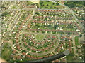
Hastings Crescent, Airedale (aerial)
Flying over one of Castleford's large estates, I thought this made a very interesting photo, showing both the imaginative layout of the streets and the feeling of open spaces, even within the town. The Y-fronts design of the green in the centre only adds to the ambience I feel.
Image: © Paul Johnston-Knight
Taken: 17 Sep 2005
0.06 miles
2
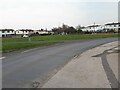
Western roundabout on Queen's Park Drive
The road runs east-west across the grid square and includes two of these large roundabouts (about 60m diameter, or 100m between facing houses). There are no side roads at this point, so the point of the roundabouts is not clear. The 1950s 6-inch map shows tree symbols, but any trees have since been removed and not replaced.
Image: © Stephen Craven
Taken: 21 Mar 2022
0.06 miles
3
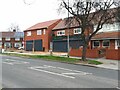
New house next to the Taj Mahal
The estate agent's copy writes itself! The plot next to this suburban takeaway in Castleford appears blank in a 2016 Streetview image, and in fact the building appears to be a pair of shop units, not yet let, with flats over, rather than entirely residential. Planning application ref. 16_02709.
Image: © Stephen Craven
Taken: 21 Mar 2022
0.11 miles
4
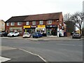
Shops on the corner of Redhill Drive
Currently comprising a barber, Premier convenience store and a hair salon.
Image: © Stephen Craven
Taken: 21 Mar 2022
0.17 miles
5

Circus on Queen's Park Drive, Castleford
Very large roundabout on Queen's Park Drive, with only two entrances/exits - encircled by residential properties.
Image: © Chris Heaton
Taken: 1 Aug 2025
0.19 miles
6
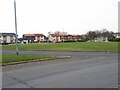
Eastern roundabout on Queen's Park Drive
The road runs east-west across the grid square and includes two of these large roundabouts (about 60m diameter, or 100m between facing houses). There are no side roads at this point, so the point of the roundabouts is not clear. The 1950s 6-inch map shows tree symbols, but any trees have since been removed and not replaced.
Image: © Stephen Craven
Taken: 21 Mar 2022
0.19 miles
7
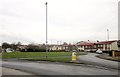
Roundabout, Airedale
The eastern of two large roundabouts on Queen's Park Drive.
Image: © Derek Harper
Taken: 5 Jan 2014
0.21 miles
8
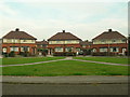
Y-Fronts Part II
Another perspective on pants, Y-front design in pathways across the small common, Airedale, Castleford.
Image: © Paul Johnston-Knight
Taken: 23 Sep 2005
0.21 miles