IMAGES TAKEN NEAR TO
Swift Way, CASTLEFORD, WF10 2SP
Introduction
This page details the photographs taken nearby to Swift Way, WF10 2SP by members of the Geograph project.
The Geograph project started in 2005 with the aim of publishing, organising and preserving representative images for every square kilometre of Great Britain, Ireland and the Isle of Man.

There are currently over 7.5m images from over14,400 individuals and you can help contribute to the project by visiting https://www.geograph.org.uk
Image Map
Images are licensed for reuse under creativecommons.org/licenses/by-sa/2.0
Notes
- Clicking on the map will re-center to the selected point.
- The higher the marker number, the further away the image location is from the centre of the postcode.
Image Listing (38 Images Found)
Images are licensed for reuse under creativecommons.org/licenses/by-sa/2.0
Image
Details
Distance
1
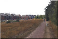
Old pit.New houses
Houses under construction on former Fryston Colliery site.
Image: © derek dye
Taken: 7 Aug 2018
0.02 miles
2
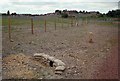
Gone without trace
From 1879 to 1986, this was the site of Fryston Colliery. Now the entire area covered by the pit and spoil tips has been turned into a country park after a year-long reclamation and landscaping scheme.
Image: © David Pickersgill
Taken: 13 Sep 2009
0.08 miles
3

Heading upstream to Castleford
A pleasure narrow boat passes the old colliery loading basin at Fryston
Image: © derek dye
Taken: 7 Aug 2018
0.08 miles
4

The River Aire.
Walking at Fairburn ings.
Image: © steven ruffles
Taken: 30 Mar 2013
0.09 miles
5

Fryston Colliery and pylons at sunset
This photograph was taken when the pit was in full production about 1980, well before the pit strike that sealed its fate. Photo taken from footpath by side of sewage works on way to footbridge crossing at three bridges over to Fairburn ings.
Image: © derek dye
Taken: Unknown
0.11 miles
6

Riverbank Trail
Path along the bank of reclaimed colliery spoil which separates the lake of Fairburn Ings from the River Aire. Contrary to appearances, Ferrybridge power station isn't actually built in the gardens of the houses on Keswick Drive, Ferry Fryston!
Image: © David Pickersgill
Taken: 2 May 2008
0.13 miles
7
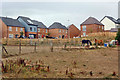
Horses and houses
Horses (NOT pit ponies) graze on the old Fryston Colliery site, whilst new houses are being built.
Image: © derek dye
Taken: 9 Aug 2018
0.14 miles
8

Picnic place
Part of the landscaping scheme on the site of Fryston Colliery. Let's hope it sees the use for which it was intended rather than as a spot to get p***ed on strong lager and cheap cider...
Image: © David Pickersgill
Taken: 13 Sep 2009
0.15 miles
9
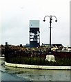
Now you see me, now you don't part 1: Fryston Colliery bites the dust
Soon after the miners strike in 1985, Fryston Colliery, along with several others, was demolished with haste and virtually all evidence that it ever existed was wiped away. The tower mounted winder was the last man standing and it took two attempts before being dynamited to the ground. See Image Exact date not known.
Image: © derek dye
Taken: Unknown
0.15 miles