
IMAGES TAKEN NEAR TO
Weir View, CASTLEFORD, WF10 2SF
Introduction
This page details the photographs taken nearby to Weir View, WF10 2SF by members of the Geograph project.
The Geograph project started in 2005 with the aim of publishing, organising and preserving representative images for every square kilometre of Great Britain, Ireland and the Isle of Man.

There are currently over 7.5m images from over14,400 individuals and you can help contribute to the project by visiting https://www.geograph.org.uk
Image Map
Images are licensed for reuse under creativecommons.org/licenses/by-sa/2.0
Notes
- Clicking on the map will re-center to the selected point.
- The higher the marker number, the further away the image location is from the centre of the postcode.
Image Listing (558 Images Found)
Images are licensed for reuse under creativecommons.org/licenses/by-sa/2.0
Image
Details
Distance
2

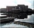
Castleford weir
The 'stuck' barge from the 'new' footbridge.
Image: © Steve Fareham
Taken: 20 Aug 2008
0.01 miles
3
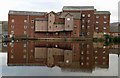
Allinsons Mill reflected in the River Aire
From the far bank after crossing by the new footbridge.
Image: © Steve Fareham
Taken: 20 Aug 2008
0.01 miles
4
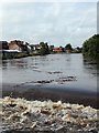
Trash torrent
A continuous stream of rubbish flows down the river Aire and over Castleford weir, washed into the water by torrential rain farther upstream. Twigs, branches, plastic bottles and footballs by the dozen: later in the day an electric cooker came over the weir.
Image: © David Pickersgill
Taken: 6 Sep 2008
0.02 miles
5

Castleford weir and footbridge
View upstream from road bridge of river Aire with Allinsons Flourmill (now closed) on the left above the modern footbridge.
Image: © derek dye
Taken: 23 Jan 2012
0.02 miles
6

Salmon ladder on Castleford weir River Aire
From the new footbridge.
Image: © Steve Fareham
Taken: 20 Aug 2008
0.02 miles
8

"Duck Island" footbridge
Piles being driven into riverbed during construction of footbridge below weir at Castleford. The Lock lane area situated between the river and the Aire & Calder navigation canal, being surrounded by water, is affectionately known as "Duck Island" to the locals.
Image: © derek dye
Taken: 1 Jul 2007
0.02 miles
9

The new Castleford footbridge over The River Aire
Twilight and night is coming but people are still enjoying the bridge.
Image: © Steve Fareham
Taken: 20 Aug 2008
0.02 miles
10

Fish Ladder
Close up of Fish Ladder on Castleford weir
Image: © derek dye
Taken: 17 Feb 2007
0.02 miles