IMAGES TAKEN NEAR TO
Merewood Road, CASTLEFORD, WF10 1QL
Introduction
This page details the photographs taken nearby to Merewood Road, WF10 1QL by members of the Geograph project.
The Geograph project started in 2005 with the aim of publishing, organising and preserving representative images for every square kilometre of Great Britain, Ireland and the Isle of Man.

There are currently over 7.5m images from over14,400 individuals and you can help contribute to the project by visiting https://www.geograph.org.uk
Image Map
Images are licensed for reuse under creativecommons.org/licenses/by-sa/2.0
Notes
- Clicking on the map will re-center to the selected point.
- The higher the marker number, the further away the image location is from the centre of the postcode.
Image Listing (36 Images Found)
Images are licensed for reuse under creativecommons.org/licenses/by-sa/2.0
Image
Details
Distance
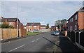
1
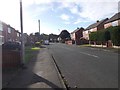
Houses on Toll Bar Road
Viewed from Methley Bridge.
Image: © Stephen Craven
Taken: 14 May 2019
0.08 miles
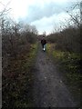
2
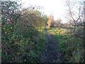
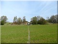
Former railway line
Now a well-used local footpath.
Image: © Christine Johnstone
Taken: 16 Nov 2010
0.10 miles
3
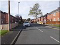
Looking towards Whitwood Junction
The newly road/path abruptly ends about 100 metres from its intended joining of the way to Cutsyke. On its previous progress, it should be completed early this year.
Image: © derek dye
Taken: 9 Mar 2018
0.11 miles
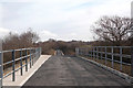
4
A brace of bridges
New footpath between Cutsyke and Whitwood Castleford on the former railway track
Image: © derek dye
Taken: 2 Jan 2017
0.12 miles
5
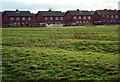
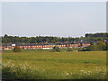
Ridge and furrow
Winter sun highlights the old ridge and furrow cultivation strips in the field to the rear of Methley Bridge Farm and the Three Lane Ends housing estate.
Image: © David Pickersgill
Taken: 20 Jan 2008
0.14 miles
6
Footpath through a field to a dismantled railway
Image: © Graham Hogg
Taken: 11 Apr 2016
0.14 miles
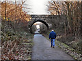
10
Footpath on disused railway line.
Unfortunately the old railway line peters out just behind the council estate and you have to leave it by the footpath to the right back to Methley Bridge.
Image: © derek dye
Taken: 30 Jan 2012
0.17 miles