
IMAGES TAKEN NEAR TO
Savile Road, CASTLEFORD, WF10 1PB
Introduction
This page details the photographs taken nearby to Savile Road, WF10 1PB by members of the Geograph project.
The Geograph project started in 2005 with the aim of publishing, organising and preserving representative images for every square kilometre of Great Britain, Ireland and the Isle of Man.

There are currently over 7.5m images from over14,400 individuals and you can help contribute to the project by visiting https://www.geograph.org.uk
Image Map
Images are licensed for reuse under creativecommons.org/licenses/by-sa/2.0
Notes
- Clicking on the map will re-center to the selected point.
- The higher the marker number, the further away the image location is from the centre of the postcode.
Image Listing (573 Images Found)
Images are licensed for reuse under creativecommons.org/licenses/by-sa/2.0
Image
Details
Distance
2
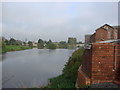
The River Aire, Castleford
This is the view of the River Aire, looking east from the car park of the Crimea Tavern.
Image: © Bill Henderson
Taken: 13 Oct 2006
0.02 miles

4
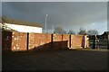
Wall in Castleford
The wall depicts different periods of history.
Image: © DS Pugh
Taken: 25 Feb 2023
0.02 miles
5

Path near Savile Road
Looking towards Savile Road in Castleford from the riverside path.
Image: © DS Pugh
Taken: 25 Feb 2023
0.03 miles
6
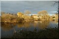
Across the River Aire
Looking across the River Aire in Castleford.
Image: © DS Pugh
Taken: 25 Feb 2023
0.03 miles

8

The former Crimea Tavern
Now a second hand furniture shop on Savile Road, Castleford.
Image: © Ian S
Taken: 22 Apr 2015
0.04 miles
9
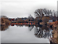
Boom on the river Aire
A boom to prevent boats going over the weir at Castleford. Approximately where the ford that gave the town the second half its name was situated. Castleford parish church in the r/h background is on the site of the roman fort/castle? that gave the town the first part of its name.
Image: © derek dye
Taken: 10 Dec 2016
0.04 miles
10
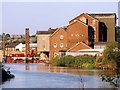
Allinsons flour mill, Castleford
A mill has stood on this site since the 12th century, the current building dates from the late 1800s. The tall iron tubes are part of a floating platform to allow work on the foundations for a new footbridge.
Image: © David Pickersgill
Taken: Unknown
0.04 miles