
IMAGES TAKEN NEAR TO
Pottery Street, CASTLEFORD, WF10 1NL
Introduction
This page details the photographs taken nearby to Pottery Street, WF10 1NL by members of the Geograph project.
The Geograph project started in 2005 with the aim of publishing, organising and preserving representative images for every square kilometre of Great Britain, Ireland and the Isle of Man.

There are currently over 7.5m images from over14,400 individuals and you can help contribute to the project by visiting https://www.geograph.org.uk
Image Map
Images are licensed for reuse under creativecommons.org/licenses/by-sa/2.0
Notes
- Clicking on the map will re-center to the selected point.
- The higher the marker number, the further away the image location is from the centre of the postcode.
Image Listing (45 Images Found)
Images are licensed for reuse under creativecommons.org/licenses/by-sa/2.0
Image
Details
Distance
1
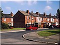
Stafford Street, Castleford
This area is still known as 'the Potteries' having been the centre of this industry in Castleford in the 19th and early 20th centuries.
Image: © David Pickersgill
Taken: 7 Oct 2007
0.01 miles
2
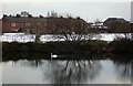
The Potteries
View of the 'Potteries' district of Castleford across the River Calder. The terraced houses are River View, the building to their right was part of Clokie & Co's pottery, the last in the town to close, in 1961.
Image: © David Pickersgill
Taken: 8 Feb 2009
0.04 miles
3
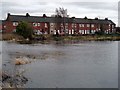
River View, Castleford
Houses in the 'potteries' district, overlooking a former bend of the river Calder. Contrast this with the drier conditions and lush vegetation of summer. http://www.geograph.org.uk/photo/11139
Image: © David Pickersgill
Taken: 20 Jan 2008
0.05 miles
4
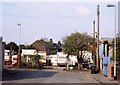
Marchant Street, Castleford
Several yards in the 'Potteries' district of Castleford are used for winter quarters and equipment storage by travelling showmen.
Image: © David Pickersgill
Taken: 7 Oct 2007
0.07 miles
5

Old pottery, Castleford
This site was the first and last place where pottery was manufactured in the town, seeing continuous production from David Dunderdale's Castleford Pottery established in 1790, through to Clokie & Co which closed in 1961. The remaining buildings date from the mid-19th century, the piles of coal mark the site of one of the cone ovens.
Image: © David Pickersgill
Taken: 7 Oct 2007
0.07 miles
6

Pottery River
It's hard to believe now, but until the middle of the 20th century barges laden with clay would sail past the houses http://www.geograph.org.uk/photo/663824 as far as here to unload at the former Clokie & Co pottery in the buildings behind the trees. It's an old bend of the river Calder - an ox-bow lake beloved of geography teachers - but has been left to silt up since the pottery closed in 1961. Now usually known as Pumphouse Pond.
Image: © David Pickersgill
Taken: 20 Jan 2008
0.07 miles
7

Old pottery, Castleford
These buildings on Pottery Street were part of Clokies pottery until its closure in 1961 and now house a variety of businesses. In the 1940s and 1950s the house was occupied by the man who supervised the firing of the traditional cone ovens.
Image: © David Pickersgill
Taken: 7 Oct 2007
0.08 miles
8

Darkening skies over the Calder path
Looking along a path running on the banks of the River Calder as it enters Castleford.
Image: © DS Pugh
Taken: 25 Feb 2023
0.09 miles
9

On the Riverside Trail
The trail here is on the floodbank of the River Calder
Image: © Graham Hogg
Taken: 11 Apr 2016
0.10 miles
10
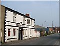
The White Lion Public House, Pottery Street, Castleford.
Image: © Bill Henderson
Taken: 17 Sep 2006
0.11 miles