
IMAGES TAKEN NEAR TO
Aire View, WF10 1FS
Introduction
This page details the photographs taken nearby to Aire View, WF10 1FS by members of the Geograph project.
The Geograph project started in 2005 with the aim of publishing, organising and preserving representative images for every square kilometre of Great Britain, Ireland and the Isle of Man.

There are currently over 7.5m images from over14,400 individuals and you can help contribute to the project by visiting https://www.geograph.org.uk
Image Map
Images are licensed for reuse under creativecommons.org/licenses/by-sa/2.0
Notes
- Clicking on the map will re-center to the selected point.
- The higher the marker number, the further away the image location is from the centre of the postcode.
Image Listing (95 Images Found)
Images are licensed for reuse under creativecommons.org/licenses/by-sa/2.0
Image
Details
Distance
1
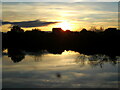
Confluence Sunset
The sun sets on Navigation point housing estate at the confluence of the rivers Aire and Calder at Castleford
Image: © derek dye
Taken: 23 Nov 2021
0.01 miles
2
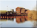
Chemical works, Castleford.
The former Lambsons (previously Laporte) plant in March 2005, now demolished to make way for housing. However, as industry disappears, the River Aire becomes cleaner and more attractive to wildlife and the fisherman.
Image: © David Pickersgill
Taken: Unknown
0.04 miles
3
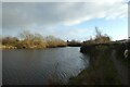
River Aire in Castleford
Looking downstream along the River Aire just after the confluence with the Calder.
Image: © DS Pugh
Taken: 25 Feb 2023
0.05 miles
4
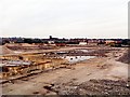
Reduced to rubble
The flattened site of the former Lambsons chemical works, Castleford, http://www.geograph.org.uk/photo/523153 awaiting clearance in preparation for housing development. All Saints parish church tower in background, plus houses along Savile Road.
Image: © David Pickersgill
Taken: Unknown
0.06 miles
5
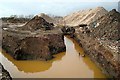
A big job
It will take a lot of work to clear soil contaminated by years of chemical dumping before the site of the former Lambsons works http://www.geograph.org.uk/photo/523153 is ready for a proposed riverside housing development 'Navigation Point'.
Image: © David Pickersgill
Taken: 20 Jan 2008
0.06 miles
6

Across the Aire towards the Aire and Calder Navigation
Looking across the River Aire in Castleford near the confluence with the River Calder.
Image: © DS Pugh
Taken: 25 Feb 2023
0.07 miles
7

Looking south at Castleford Junction
The unnavigable River Aire heading downstream to the weir in the middle of Castleford.
Image: © Christine Johnstone
Taken: 19 Jun 2015
0.07 miles
8
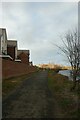
New housing and river path
Looking along the path in Castleford beside the River Aire.
Image: © DS Pugh
Taken: 25 Feb 2023
0.08 miles
9

Boat at confluence of river Calder and river Aire at Castleford
Image: © derek dye
Taken: 31 Jul 2020
0.08 miles
10

Fencing along the river path
Looking along the path on the riverbank with construction underway on new housing.
Image: © DS Pugh
Taken: 25 Feb 2023
0.08 miles