IMAGES TAKEN NEAR TO
St. Marys Terrace, High Street, BOREHAMWOOD, WD6 3HA
Introduction
This page details the photographs taken nearby to St. Marys Terrace, High Street, WD6 3HA by members of the Geograph project.
The Geograph project started in 2005 with the aim of publishing, organising and preserving representative images for every square kilometre of Great Britain, Ireland and the Isle of Man.

There are currently over 7.5m images from over14,400 individuals and you can help contribute to the project by visiting https://www.geograph.org.uk
Image Map (Loading...)


Getting Data...Please wait
Leaflet Map data © OpenStreetMap
Images are licensed for reuse under creativecommons.org/licenses/by-sa/2.0
Notes
- Clicking on the map will re-center to the selected point.
- The higher the marker number, the further away the image location is from the centre of the postcode.
Image Listing (50 Images Found)
Images are licensed for reuse under creativecommons.org/licenses/by-sa/2.0
Image
Details
Distance
1
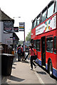
Edgware Service
Passengers board and disembark from a 107 bus on route to Edgware from New Barnet. London red buses and rural bus stops are not a common combination especially in the current Transport for London era and Elstree Village probably represents a frontier post!
Image: © Martin Addison
Taken: 21 Apr 2011
0.01 miles
2
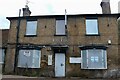
Derelict restaurant on Watling Street, Elstree
Image: © David Howard
Taken: 22 Aug 2021
0.01 miles
3
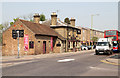
The East
Located at the junction of the A5183 Elstree North Hill and the A411 Watford Road this Asian restaurant was previously The Plough public house, which opened circa 1830.
Image: © Martin Addison
Taken: 21 Apr 2011
0.02 miles
5
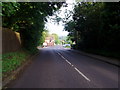
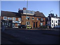
The junction of Barnet Road with Elstree High Street
Elstree High Street follows the course of Watling Street (Roman road).
Image: © Bikeboy
Taken: 23 Jun 2012
0.04 miles
6
Watford Road at the junction of High Street, Elstree
Image: © David Howard
Taken: 27 Jan 2021
0.04 miles
8
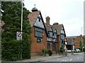
The Liberal Synagogue, Elstree
Formerly a school, grade II listed, 1880s.
Image: © Robin Webster
Taken: 14 Jun 2015
0.05 miles
9
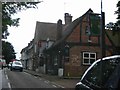
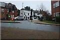
Pub in Elstree
This shot was taken through the windscreen whilst waiting for the traffic lights to change
Image: © Jack Hill
Taken: 7 Jul 2005
0.05 miles
10
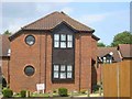
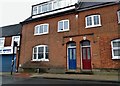
Housing in Elstree
This housing group has a friendly sign saying
"private housing, no parking, no turning."
Image: © Jack Hill
Taken: 7 Jul 2005
0.05 miles