IMAGES TAKEN NEAR TO
Chipperfield, KINGS LANGLEY, WD4 9BP
Introduction
This page details the photographs taken nearby to WD4 9BP by members of the Geograph project.
The Geograph project started in 2005 with the aim of publishing, organising and preserving representative images for every square kilometre of Great Britain, Ireland and the Isle of Man.

There are currently over 7.5m images from over14,400 individuals and you can help contribute to the project by visiting https://www.geograph.org.uk
Image Map
Images are licensed for reuse under creativecommons.org/licenses/by-sa/2.0
Notes
- Clicking on the map will re-center to the selected point.
- The higher the marker number, the further away the image location is from the centre of the postcode.
Image Listing (10 Images Found)
Images are licensed for reuse under creativecommons.org/licenses/by-sa/2.0
Image
Details
Distance
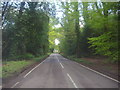
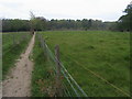
2
Bucks Hill, near Chipperfield
Bucks Hill, in the west Hertfordshire countryside.
Image: © Malc McDonald
Taken: 26 Sep 2015
0.14 miles
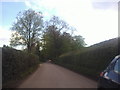
3
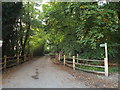
Farm access driveway near Chipperfield
The access driveway to Gyfres Farm at Bucks Hill, in western Hertfordshire.
Image: © Malc McDonald
Taken: 26 Sep 2015
0.15 miles
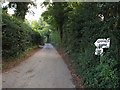
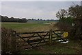
4
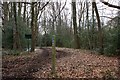
Access road on Chipperfield Common
The signpost to the right of the image indicates this access road is a public right of way for people on foot.
Image: © Malc McDonald
Taken: 26 Sep 2015
0.16 miles
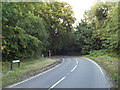
5
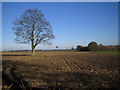
Chipperfield: Lone tree in farmland off Bucks Hill road
Viewed looking eastwards.
Image: © Nigel Cox
Taken: 29 Jan 2006
0.17 miles
6
Eastern entrance to Chipperfield Common
Image: © Simon Mortimer
Taken: 27 Mar 2013
0.17 miles
7
Bucks Hill, near Chipperfield
Bucks Hill, in the west Hertofrdshire countryside.
Image: © Malc McDonald
Taken: 26 Sep 2015
0.18 miles
8
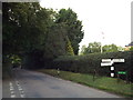
Footpath to Chipperfield Common
From Commonwood the footpath to Chipperfield Common
Image: © Shaun Ferguson
Taken: 7 May 2010
0.20 miles
9
Farmland at Bucks Hill
Looking east from the road at the northern edge of the settlement.
Image: © Simon Mortimer
Taken: 27 Mar 2013
0.22 miles