IMAGES TAKEN NEAR TO
Langley Lodge Lane, KINGS LANGLEY, WD4 8QN
Introduction
This page details the photographs taken nearby to Langley Lodge Lane, WD4 8QN by members of the Geograph project.
The Geograph project started in 2005 with the aim of publishing, organising and preserving representative images for every square kilometre of Great Britain, Ireland and the Isle of Man.

There are currently over 7.5m images from over14,400 individuals and you can help contribute to the project by visiting https://www.geograph.org.uk
Image Map
Images are licensed for reuse under creativecommons.org/licenses/by-sa/2.0
Notes
- Clicking on the map will re-center to the selected point.
- The higher the marker number, the further away the image location is from the centre of the postcode.
Image Listing (4 Images Found)
Images are licensed for reuse under creativecommons.org/licenses/by-sa/2.0
Image
Details
Distance
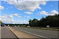
2
Kings Langley: Langley Lodge Lane
Viewed looking eastwards with Sunbury Hill Farm to the left.
Image: © Nigel Cox
Taken: 29 Jan 2006
0.23 miles
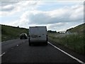
3
Kings Langley By-Pass
The A41 now avoids Kings Langley and the Gade Valley, taking the high road to the west of the village.
Image: © Colin Smith
Taken: 27 Sep 2009
0.24 miles