IMAGES TAKEN NEAR TO
Furze View, RICKMANSWORTH, WD3 5HU
Introduction
This page details the photographs taken nearby to Furze View, WD3 5HU by members of the Geograph project.
The Geograph project started in 2005 with the aim of publishing, organising and preserving representative images for every square kilometre of Great Britain, Ireland and the Isle of Man.

There are currently over 7.5m images from over14,400 individuals and you can help contribute to the project by visiting https://www.geograph.org.uk
Image Map
Images are licensed for reuse under creativecommons.org/licenses/by-sa/2.0
Notes
- Clicking on the map will re-center to the selected point.
- The higher the marker number, the further away the image location is from the centre of the postcode.
Image Listing (17 Images Found)
Images are licensed for reuse under creativecommons.org/licenses/by-sa/2.0
Image
Details
Distance
1
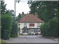
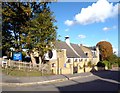
The Stag at Swillets Chorleywood.
The road to the left at the T-junction becomes very narrow almost one track but is a link with the M25.
Image: © Jack Hill
Taken: 19 Jul 2005
0.09 miles
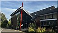
2
St Andrew, Chorleywood: mid August 2016
Image: © Basher Eyre
Taken: 13 Aug 2016
0.16 miles
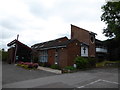
3
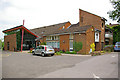
St Andrew's Church, Chorleywood
The building dates from 1966 with subsequent additions.
Image: © Ian Capper
Taken: 5 Jun 2010
0.17 miles
5
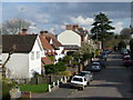
Haddon Road, Chorleywood; late afternoon
Village or town? Chorleywood exhibits attributes of both.
Image: © Jonathan Billinger
Taken: 7 Apr 2008
0.19 miles
6
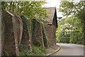
Berry Lane Chorleywood
View to the West after ascending short hill toward the junction with the northerly extent of Shepherd's Lane. Buildings shown in vicinity and to the South date back to the time of King John
Image: © Mike Bruce
Taken: 6 May 2007
0.19 miles
7
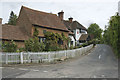
Shepherds Lane Chorleywood
View to the south east at the junction of Berry Lane to the Northerly extent of Shepherds Lane. White building in the back is known as King John's Farm
Image: © Mike Bruce
Taken: 6 May 2007
0.21 miles
10
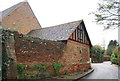
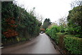
Penn Farm
Grade II* listed. http://www.britishlistedbuildings.co.uk/en-158726-kings-john-s-farm-penn-cottage-penn-farm
See also Image Image & Image
Image: © N Chadwick
Taken: 27 Dec 2012
0.23 miles