IMAGES TAKEN NEAR TO
Berry Lane, RICKMANSWORTH, WD3 5EY
Introduction
This page details the photographs taken nearby to Berry Lane, WD3 5EY by members of the Geograph project.
The Geograph project started in 2005 with the aim of publishing, organising and preserving representative images for every square kilometre of Great Britain, Ireland and the Isle of Man.

There are currently over 7.5m images from over14,400 individuals and you can help contribute to the project by visiting https://www.geograph.org.uk
Image Map
Images are licensed for reuse under creativecommons.org/licenses/by-sa/2.0
Notes
- Clicking on the map will re-center to the selected point.
- The higher the marker number, the further away the image location is from the centre of the postcode.
Image Listing (68 Images Found)
Images are licensed for reuse under creativecommons.org/licenses/by-sa/2.0
Image
Details
Distance
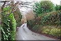
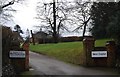
9
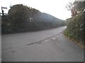
Berry Lane at the junction of Common Gate Road
Image: © David Howard
Taken: 20 Oct 2016
0.14 miles
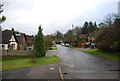
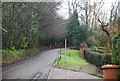
10

Chorleywood Bottom
Looking down from close to the railway bridge to houses on Commongate Road.
Image: © Stephen McKay
Taken: 2 Dec 2013
0.14 miles