IMAGES TAKEN NEAR TO
Chorleywood Road, RICKMANSWORTH, WD3 4EY
Introduction
This page details the photographs taken nearby to Chorleywood Road, WD3 4EY by members of the Geograph project.
The Geograph project started in 2005 with the aim of publishing, organising and preserving representative images for every square kilometre of Great Britain, Ireland and the Isle of Man.

There are currently over 7.5m images from over14,400 individuals and you can help contribute to the project by visiting https://www.geograph.org.uk
Image Map
Images are licensed for reuse under creativecommons.org/licenses/by-sa/2.0
Notes
- Clicking on the map will re-center to the selected point.
- The higher the marker number, the further away the image location is from the centre of the postcode.
Image Listing (32 Images Found)
Images are licensed for reuse under creativecommons.org/licenses/by-sa/2.0
Image
Details
Distance
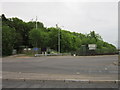
2
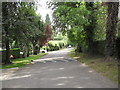
Troutstream Way
A private road in Loudwater.
Image: © Burgess Von Thunen
Taken: 6 Sep 2012
0.07 miles
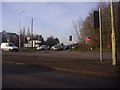
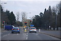
3
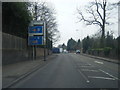
Rickmansworth - Chestnut Avenue
Detached stately homes near the M25.
Image: © James Emmans
Taken: 21 Jan 2017
0.08 miles
5
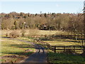
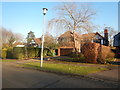
Paddocks by Little Lady's Wood, Rickmansworth
View across the paddocks north-east to Loudwater
Image: © David Hawgood
Taken: 28 Feb 2006
0.09 miles
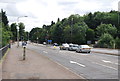
9
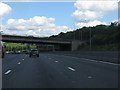
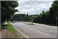
M25 motorway - junction 18 bridge (A404)
Image: © Peter Whatley
Taken: 19 Jun 2012
0.11 miles