IMAGES TAKEN NEAR TO
Northway, RICKMANSWORTH, WD3 1ZR
Introduction
This page details the photographs taken nearby to Northway, WD3 1ZR by members of the Geograph project.
The Geograph project started in 2005 with the aim of publishing, organising and preserving representative images for every square kilometre of Great Britain, Ireland and the Isle of Man.

There are currently over 7.5m images from over14,400 individuals and you can help contribute to the project by visiting https://www.geograph.org.uk
Image Map
Images are licensed for reuse under creativecommons.org/licenses/by-sa/2.0
Notes
- Clicking on the map will re-center to the selected point.
- The higher the marker number, the further away the image location is from the centre of the postcode.
Image Listing (169 Images Found)
Images are licensed for reuse under creativecommons.org/licenses/by-sa/2.0
Image
Details
Distance
1

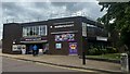
Three Rivers House, Northway
This building was constructed in 1991, and acts as the base for both Three Rivers District Council and Rickmansworth's police station.
Image: © Bryn Holmes
Taken: 7 Apr 2022
0.01 miles
3
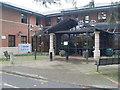
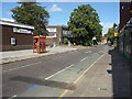
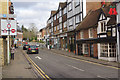
New Police Station, Rickmansworth
Opened in early February,2011, the police station is now located in Three Rivers House, the offices of Three Rivers District Council, having transferred from the former site in Rectory Road, TQ0594 refers http://www.geograph.org.uk/photo/2285147. The sign indicating that it is a police station can be seen to the left of the photo, having previously been in front of the former police station.
Image: © David Hillas
Taken: 22 Feb 2011
0.04 miles
5
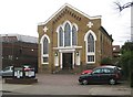
Rickmansworth: Baptist Church
The Church is on the High Street and was built in 1843. A.D. and 1843 are carved into the stonework of the two high clover-shaped crosses above the side windows.
Image: © Nigel Cox
Taken: 19 Apr 2015
0.05 miles
8
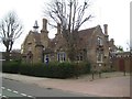
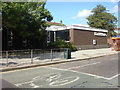
Rickmansworth: Gable House
Gable House on the High Street was originally built in 1847 as the town's National School, which educated children of the poor. It is not a nationally Listed Building and today is in use as offices.
Image: © Nigel Cox
Taken: 19 Apr 2015
0.06 miles
10
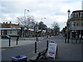
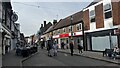
Church Street, Rickmansworth
Church Street connects the High Street with St Mary's Church; this is looking towards the junction with the High Street. On the right is Cinnamon Square, an upmarket bakery.
Image: © Stephen McKay
Taken: 11 Jan 2017
0.08 miles