IMAGES TAKEN NEAR TO
Plaitford Close, RICKMANSWORTH, WD3 1NJ
Introduction
This page details the photographs taken nearby to Plaitford Close, WD3 1NJ by members of the Geograph project.
The Geograph project started in 2005 with the aim of publishing, organising and preserving representative images for every square kilometre of Great Britain, Ireland and the Isle of Man.

There are currently over 7.5m images from over14,400 individuals and you can help contribute to the project by visiting https://www.geograph.org.uk
Image Map
Images are licensed for reuse under creativecommons.org/licenses/by-sa/2.0
Notes
- Clicking on the map will re-center to the selected point.
- The higher the marker number, the further away the image location is from the centre of the postcode.
Image Listing (131 Images Found)
Images are licensed for reuse under creativecommons.org/licenses/by-sa/2.0
Image
Details
Distance
2
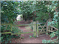
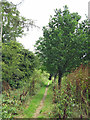
Gate on the path down to Sherfield Avenue
Image: © Mike Quinn
Taken: 7 Aug 2019
0.08 miles
3
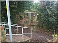
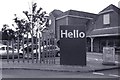
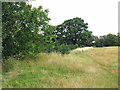
Electricity sub station, Sherfield Avenue
Image: © Alex McGregor
Taken: 7 Jan 2015
0.08 miles
7
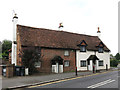
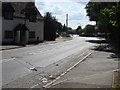
21 & 25, Harefield Road
This pair of semi-detached houses was originally a late 16th C agricultural building which was converted into a house in the late 17th/early 18th C and divided into two cottages in the early 19th C. The building is Grade II listed https://historicengland.org.uk/listing/the-list/list-entry/1348224 .
Image: © Mike Quinn
Taken: 7 Aug 2019
0.13 miles
9
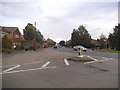
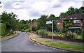
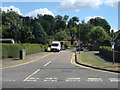
Frogmoor Lane at the junction of Harefield Road
Image: © David Howard
Taken: 20 Oct 2016
0.16 miles