IMAGES TAKEN NEAR TO
WC2B 6JA
Introduction
This page details the photographs taken nearby to WC2B 6JA by members of the Geograph project.
The Geograph project started in 2005 with the aim of publishing, organising and preserving representative images for every square kilometre of Great Britain, Ireland and the Isle of Man.

There are currently over 7.5m images from over14,400 individuals and you can help contribute to the project by visiting https://www.geograph.org.uk
Image Map
Images are licensed for reuse under creativecommons.org/licenses/by-sa/2.0
Notes
- Clicking on the map will re-center to the selected point.
- The higher the marker number, the further away the image location is from the centre of the postcode.
Image Listing (1405 Images Found)
Images are licensed for reuse under creativecommons.org/licenses/by-sa/2.0
Image
Details
Distance
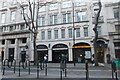
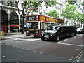
5
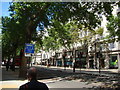
View up Kingsway
Looking north-northwest.
Image: © Robert Lamb
Taken: 8 Jun 2013
0.01 miles
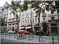
6
Looking across Kingsway into Keeley Street
Image: © Basher Eyre
Taken: 12 Jul 2008
0.02 miles
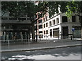
7
London School of Economics, Sardinia House
Image: © N Chadwick
Taken: 7 Aug 2018
0.02 miles
8
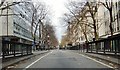
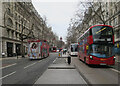
Kingsway, on Christmas Day 2011
Surely the only day of the year when this London thoroughfare is so traffic-free and depopulated.
Kingsway is by no means ancient - it owes its origin to Victorian 'social engineering'. Its alignment was chosen in order to destroy one of London's great 'rookeries' - an area of densely settled slums. A number of London's best known streets had similar beginnings: Charing Cross Road and New Oxford Street were both designed to rip into the great rookery of St Giles's, and succeeded to the extent that the name 'St Giles's' was all but wiped off the map. (St Giles's High Street still exists, but as a backwater, and the local tube station is 'Tottenham Court Road'). Further south and west, Victoria Street was cut through the slums of Westminster, another notorious area by early Victorian times.
Image: © Stefan Czapski
Taken: 25 Dec 2011
0.03 miles
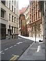
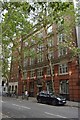
9
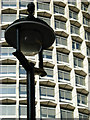
One Kemble Street
One Kemble Street is an imposing office block designed by Richard Seifert and built between 1964 and 1968. It is very similar in architectural style to the better known Centre Point, although not so tall.
Image: © Stephen McKay
Taken: 19 Oct 2007
0.03 miles
10
Wedding bound stretched Hummer in Kingway
Image: © Basher Eyre
Taken: 12 Jul 2008
0.03 miles