IMAGES TAKEN NEAR TO
Nazareth House Lane, WIDNES, WA8 8UE
Introduction
This page details the photographs taken nearby to Nazareth House Lane, WA8 8UE by members of the Geograph project.
The Geograph project started in 2005 with the aim of publishing, organising and preserving representative images for every square kilometre of Great Britain, Ireland and the Isle of Man.

There are currently over 7.5m images from over14,400 individuals and you can help contribute to the project by visiting https://www.geograph.org.uk
Image Map
Images are licensed for reuse under creativecommons.org/licenses/by-sa/2.0
Notes
- Clicking on the map will re-center to the selected point.
- The higher the marker number, the further away the image location is from the centre of the postcode.
Image Listing (8 Images Found)
Images are licensed for reuse under creativecommons.org/licenses/by-sa/2.0
Image
Details
Distance
2
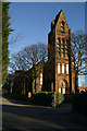
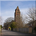
Looming presence
St. Michael's RC Church, which used to loom over the Nazareth House orphanage nearby.
Image: © David Long
Taken: 8 Feb 2006
0.07 miles
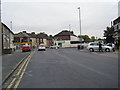
6
Junction of St. Michael's Road, Hale Road and Ditchfield Road, Ditton
Image: © Richard Cooke
Taken: 7 Jan 2018
0.15 miles