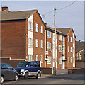
IMAGES TAKEN NEAR TO
Halegate Road, WIDNES, WA8 8LR

Introduction

This page details the photographs taken nearby to Halegate Road, WA8 8LR by members of the Geograph project.

The Geograph project started in 2005 with the aim of publishing, organising and preserving representative images for every square kilometre of Great Britain, Ireland and the Isle of Man.

There are currently over 7.5m images from over14,400 individuals and you can help contribute to the project by visiting https://www.geograph.org.uk

Image Map


Images are licensed for reuse under creativecommons.org/licenses/by-sa/2.0
Notes
  • Clicking on the map will re-center to the selected point.
  • The higher the marker number, the further away the image location is from the centre of the postcode.

Image Listing (14 Images Found)

Images are licensed for reuse under creativecommons.org/licenses/by-sa/2.0
Image
Details
Distance
1
The Mersey View at Hale Bank
Image: © Raymond Knapman Taken: 7 Sep 2010
0.09 miles
2
Mersey View pub, Hale Bank
Image: © Bikeboy Taken: 10 Apr 2014
0.10 miles
3
'Mersey View' junction at Hale Bank
Image: © Row17 Taken: 19 Jun 2009
0.11 miles
4
Converted chapel at Hale Bank
Halton (Hale Bank). Converted chapel on Hale Road. I wonder what the founders of the chapel would have made of the Chi-Nar Restaurant and Oddie's Social Club? Ut tempora ut mores.
Image: © Mike Harris Taken: 26 Aug 2006
0.11 miles
5
Hale Court
Image: © Ian Greig Taken: 2 Mar 2012
0.12 miles
6
Denise's Off Licence and Luke's Chippy, Hale Road.
Image: © Colin Pyle Taken: 22 Feb 2010
0.12 miles
7
Cock and Trumpet Public House, Halebank
Image: © Sue Adair Taken: 5 Feb 2007
0.13 miles
8
Halebank Oddfellows Hall
Halebank Oddfellows Hall in Hale Road, opened in 1924. It is now a Chinese Restaurant amongst other things.
Image: © Sue Adair Taken: 21 Mar 2007
0.14 miles
9
Pickerings Pasture
A nature reserve on the trans pennine trail on the bank of the Mersey near Hale Bank. Runcorn bridge is in the distance.
Image: © Gary Rogers Taken: 6 Jul 2005
0.15 miles
10
Pickerings Pasture
Information board describing how the area was reclaimed from wasteland.
Image: © Gary Rogers Taken: 6 Jul 2005
0.15 miles