IMAGES TAKEN NEAR TO
Wilmere Lane, WIDNES, WA8 5UY
Introduction
This page details the photographs taken nearby to Wilmere Lane, WA8 5UY by members of the Geograph project.
The Geograph project started in 2005 with the aim of publishing, organising and preserving representative images for every square kilometre of Great Britain, Ireland and the Isle of Man.

There are currently over 7.5m images from over14,400 individuals and you can help contribute to the project by visiting https://www.geograph.org.uk
Image Map (Loading...)


Getting Data...Please wait
Leaflet Map data © OpenStreetMap
Images are licensed for reuse under creativecommons.org/licenses/by-sa/2.0
Notes
- Clicking on the map will re-center to the selected point.
- The higher the marker number, the further away the image location is from the centre of the postcode.
Image Listing (16 Images Found)
Images are licensed for reuse under creativecommons.org/licenses/by-sa/2.0
Image
Details
Distance
1
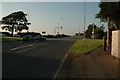
Crossroads along A57 near Rainhill
This is the crossroads at the meeting of Warrington Road (A57) and Jubits Lane/Wilmere Lane (A5419).
Image: © andy
Taken: 26 Jun 2005
0.04 miles
3

Poppy Tractor by Caroline Jones
Art work on display outside Brookview Livery Farm in Bold Heath.
Image: © Matt Harrop
Taken: 28 Nov 2017
0.11 miles

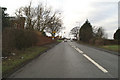
8

The morning rush hour on the A557
Or it was till I got my camera out. I wonder if my camera will have the same effect on the M6 during my morning commute?
Image: © Ian Greig
Taken: 23 Oct 2009
0.18 miles
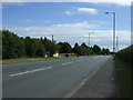
10
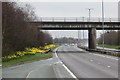
A557
Links the M62 and Widnes. It would have been a good route around the imobile M6 and M56 if it were not for road closures in Runcorn and losing the diversion route.
Image: © Richard Webb
Taken: 3 Apr 2015
0.19 miles