IMAGES TAKEN NEAR TO
Calder Close, WIDNES, WA8 3YT

Introduction

This page details the photographs taken nearby to Calder Close, WA8 3YT by members of the Geograph project.

The Geograph project started in 2005 with the aim of publishing, organising and preserving representative images for every square kilometre of Great Britain, Ireland and the Isle of Man.

There are currently over 7.5m images from over14,400 individuals and you can help contribute to the project by visiting https://www.geograph.org.uk

Image Map


Images are licensed for reuse under creativecommons.org/licenses/by-sa/2.0
Notes
  • Clicking on the map will re-center to the selected point.
  • The higher the marker number, the further away the image location is from the centre of the postcode.

Image Listing (5 Images Found)

Images are licensed for reuse under creativecommons.org/licenses/by-sa/2.0
Image
Details
Distance
1
The end of Barneston Road, in the shadow of Fiddler's Ferry Power Station
Image: © Ian Greig Taken: 9 Mar 2012
0.04 miles
2
Entering Widnes on the A562
Image: © JThomas Taken: 24 Mar 2012
0.17 miles
3
Clock Lane Farm, Dan's Road
Image: © Sue Adair Taken: 19 Sep 2008
0.19 miles
4
Sunset over the garden wall
Actually my back garden and may not be a true Geograph?
Image: © Colin Wynne-Parle Taken: 25 Nov 2001
0.24 miles
5
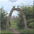
Through the arched window
A carved wooden arch marks the entrance to a conservation area to the south of the railway line. The cooling towers of Fiddlers Ferry power station rise above the roofs of some of the 60's - 70's houses on the estate to the south
Image: © Gary Rogers Taken: 1 Jul 2005
0.24 miles