IMAGES TAKEN NEAR TO
St. Marys Road, WIDNES, WA8 0ED

Introduction

This page details the photographs taken nearby to St. Marys Road, WA8 0ED by members of the Geograph project.

The Geograph project started in 2005 with the aim of publishing, organising and preserving representative images for every square kilometre of Great Britain, Ireland and the Isle of Man.

There are currently over 7.5m images from over14,400 individuals and you can help contribute to the project by visiting https://www.geograph.org.uk

Image Map


Images are licensed for reuse under creativecommons.org/licenses/by-sa/2.0
Notes
  • Clicking on the map will re-center to the selected point.
  • The higher the marker number, the further away the image location is from the centre of the postcode.

Image Listing (133 Images Found)

Images are licensed for reuse under creativecommons.org/licenses/by-sa/2.0
  • ...
Image
Details
Distance
1
St Mary's Church, Widnes
Viewed against the setting sun from the banks of the Mersey near the Runcorn Bridge.
Image: © Matt Harrop Taken: 24 Jun 2015
0.04 miles
2
The Mersey Public House Beer Garden
Image: © Galatas Taken: 18 Jan 2011
0.04 miles
3
The Runcorn Ferry
This was a natural location for a ferry across the River Mersey, and the ferry lasted until the erection of the Transporter Bridge. This in turn succumbed with the opening of the current bridge, which can be seen to the left. The viewpoint is more or less where the Transporter Bridge would have been on the Runcorn side; the Widnes pier with its toll house can be seen on the far side.
Image: © Alan Murray-Rust Taken: 6 Oct 2008
0.04 miles
4
View across the Runcorn Gap
Looking from the Manchester Ship Canal on the south side, north towards West Side, Widnes with St Mary's church prominent.
Image: © Trevor Harris Taken: 2 Sep 2012
0.05 miles
5
The Mersey public house
The Mersey Road once led to the Transporter bridge
Image: © Raymond Knapman Taken: 7 Sep 2010
0.05 miles
6
Jubilee Bridge
Jubilee Bridge connects Widnes and Runcorn
Image: © Galatas Taken: 6 Nov 2007
0.06 miles
7
St Mary's Church, West Bank, Widnes
Image: © JThomas Taken: 24 Mar 2012
0.06 miles
8
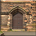
St Mary's Church, Doorway Detail
The doorway of Image] with the latin religious text over the oak panelled door and the text "what hath God wrought" inscribed in the stonework. St Mary's Church is on St Mary's Road, above Victoria Promenade, in the West Bank area of Widnes. The church, built in red flecked sandstone, is designated by English Heritage as a Grade II* listed building (http://www.britishlistedbuildings.co.uk/en-56062-church-of-st-mary- British Listed Buildings). It is an active Anglican parish church, the foundation stone was laid on 14 May 1908 and the church was opened on 12 November 1910.
Image: © David Dixon Taken: 26 Apr 2013
0.06 miles
9
St Mary's Church from the ship canal
Image: © SMJ Taken: 2 Aug 2011
0.06 miles
10
St. Mary, West Bank, Widnes
Seen from the riverside promenade.
Image: © Jonathan Thacker Taken: 5 Mar 1987
0.06 miles
  • ...