IMAGES TAKEN NEAR TO
Bayswater Close, RUNCORN, WA7 1NY

Introduction

This page details the photographs taken nearby to Bayswater Close, WA7 1NY by members of the Geograph project.

The Geograph project started in 2005 with the aim of publishing, organising and preserving representative images for every square kilometre of Great Britain, Ireland and the Isle of Man.

There are currently over 7.5m images from over14,400 individuals and you can help contribute to the project by visiting https://www.geograph.org.uk

Image Map


Images are licensed for reuse under creativecommons.org/licenses/by-sa/2.0
Notes
  • Clicking on the map will re-center to the selected point.
  • The higher the marker number, the further away the image location is from the centre of the postcode.

Image Listing (7 Images Found)

Images are licensed for reuse under creativecommons.org/licenses/by-sa/2.0
Image
Details
Distance
1
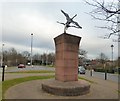
Public art at Keckwick
On a grassy open space between Calmington Lane and Stalbridge Drive at Keckwick is a prominent piece of public art. It doesn't seem to carry an explanatory plaque and all my attempts to find any information about it have drawn a blank. Who is the sculptor? Who commissioned it? When was it erected? I don't know.
Image: © Gerald England Taken: 18 Mar 2016
0.12 miles
2
Public art at Keckwick
On a grassy open space between Calmington Lane and Stalbridge Drive at Keckwick is a prominent piece of public art. It doesn't seem to carry an explanatory plaque and all my attempts to find any information about it have drawn a blank. Who is the sculptor? Who commissioned it? When was it erected? I don't know.
Image: © Gerald England Taken: 18 Mar 2016
0.12 miles
3
Sculpture at Keckwick
On a grassy open space between Calmington Lane and Stalbridge Drive at Keckwick is a prominent piece of public art. It doesn't seem to carry an explanatory plaque and all my attempts to find any information about it have drawn a blank. Who is the sculptor? Who commissioned it? When was it erected? I don't know.
Image: © Gerald England Taken: 18 Mar 2016
0.12 miles
4
Daresbury Expressway roundabout
Image: © Colin Pyle Taken: 30 Dec 2011
0.15 miles
5
Elizabeth II postbox on Keckwick Lane, Daresbury
Postbox No. WA4 144.
Image: © JThomas Taken: 25 Jul 2023
0.16 miles
6
Moore Meadows
Moore Meadows, a public open space transformed from farmland and originally flooded marshland. Recently a cycle path has been made which meanders through the open meadows and areas planted with trees with benches dotted about where one can sit and enjoy the scenery.
Image: © Sue Adair Taken: 2 Mar 2008
0.23 miles
7
Road works at Sandymoor
Image: © Ian Greig Taken: 12 Apr 2013
0.24 miles