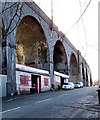
IMAGES TAKEN NEAR TO
Cawdor Street, RUNCORN, WA7 1EN

Introduction

This page details the photographs taken nearby to Cawdor Street, WA7 1EN by members of the Geograph project.

The Geograph project started in 2005 with the aim of publishing, organising and preserving representative images for every square kilometre of Great Britain, Ireland and the Isle of Man.

There are currently over 7.5m images from over14,400 individuals and you can help contribute to the project by visiting https://www.geograph.org.uk

Image Map


Images are licensed for reuse under creativecommons.org/licenses/by-sa/2.0
Notes
  • Clicking on the map will re-center to the selected point.
  • The higher the marker number, the further away the image location is from the centre of the postcode.

Image Listing (222 Images Found)

Images are licensed for reuse under creativecommons.org/licenses/by-sa/2.0
  • ...
Image
Details
Distance
1
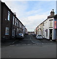
Cawdor Street, Runcorn
From Brindley Street along Cawdor Street towards Trentham Street. The 30mph speed limit drops to 20mph. Jacky Chen Chinese takeaway http://www.geograph.org.uk/photo/5543650 is on the right.
Image: © Jaggery Taken: 4 Feb 2017
0.01 miles
2
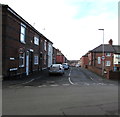
Suffolk Street, Runcorn
From Brindley Street along Suffolk Street towards Trentham Street. The 30mph speed limit drops to 20mph.
Image: © Jaggery Taken: 4 Feb 2017
0.01 miles
3
Jacky Chen, Runcorn
Jacky Chen Chinese takeaway is on the corner of Cawdor Street and Brindley Street.
Image: © Jaggery Taken: 4 Feb 2017
0.03 miles
4
Runcorn - railway viaduct alongside Ashridge Street
Image: © Dave Bevis Taken: 9 Aug 2012
0.03 miles
5
Portland Street, Runcorn
From Brindley Street along Portland Street towards Trentham Street. The 30mph speed limit drops to 20mph.
Image: © Jaggery Taken: 4 Feb 2017
0.03 miles
6
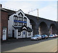
Runcorn Spiritualist Church, Runcorn
This is the Ashridge Street side of the building dated 1888. http://www.geograph.org.uk/photo/5544690 The church extends under a railway viaduct arch to Brindley Street.
Image: © Jaggery Taken: 4 Feb 2017
0.04 miles
7
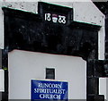
Year 1888 on Runcorn Spiritualist Church, Ashridge Street, Runcorn
Located here. http://www.geograph.org.uk/photo/5544686
Image: © Jaggery Taken: 4 Feb 2017
0.04 miles
8
Square Peg in a Round Hole
The rear of Runcorn Spiritualist Church in Ashridge Street, originally built in 1888 as a Mission Hall and classroom by Mr G Marshall, a local chemist who was also an evangelist preacher. Since 1908, when it was bought by a group of Spiritualists, it has provided for the poor in the Dukesfield area, especially at Christmas-time when the children went along for a Christmas breakfast and a little present. The church sits beneath the arch of “The Queen Ethelfleda Viaduct” which is the correct name of the railway bridge which crosses the River Mersey at Runcorn.
Image: © Sue Adair Taken: 3 Apr 2009
0.04 miles
9
Runcorn - Spiritualist Church
This church is partly covered by an arch of the railway viaduct. The church has a date-stone of 1888, whereas the viaduct was built in 1868. Therefore, the church must have been built under the viaduct, rather than the viaduct built over the church. This photo shows the Ashridge Street frontage to the church. Photo Image shows the Brindley Street side of the church.
Image: © Dave Bevis Taken: 9 Aug 2012
0.04 miles
10
Underneath the arches, Brindley Street, Runcorn
Dukesfield Tyres on the left, Arch Motors next door/arch.
Image: © Jaggery Taken: 4 Feb 2017
0.04 miles
  • ...