IMAGES TAKEN NEAR TO
Castle Park, FRODSHAM, WA6 6SB
Introduction
This page details the photographs taken nearby to Castle Park, WA6 6SB by members of the Geograph project.
The Geograph project started in 2005 with the aim of publishing, organising and preserving representative images for every square kilometre of Great Britain, Ireland and the Isle of Man.

There are currently over 7.5m images from over14,400 individuals and you can help contribute to the project by visiting https://www.geograph.org.uk
Image Map
Images are licensed for reuse under creativecommons.org/licenses/by-sa/2.0
Notes
- Clicking on the map will re-center to the selected point.
- The higher the marker number, the further away the image location is from the centre of the postcode.
Image Listing (60 Images Found)
Images are licensed for reuse under creativecommons.org/licenses/by-sa/2.0
Image
Details
Distance
1
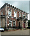
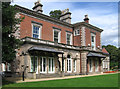
Castle Park House. Frodsham
Rebuilt in the 1850s, probably by T.M. Penson, for a Warrington manufacturer.
Its grounds are a public park and the house is at least partly used as council offices.
Image: © Stephen Richards
Taken: 17 Jun 2016
0.01 miles
3
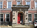
Frodsham - Castle Park House - entrance porch
Image: © Dave Bevis
Taken: 28 Aug 2012
0.01 miles
4
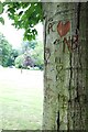
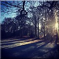
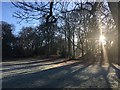
Tree of Love, Castle Park, Frodsham
Castle Park was a private garden which was donated to the town of Frodsham in 1933. It has been used as a public park ever since. The park, which covers 6.5 hectares, has recently undergone a regeneration project to create a new sports and conference centre.
Image: © Matt Harrop
Taken: 15 Jun 2015
0.03 miles
5

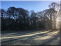
Castle Park fountain, Frodsham
This fountain can be found at the heart of the small rose garden.
Image: © Matt Harrop
Taken: 15 Jun 2015
0.03 miles
9

Rail Bridge, Chester Road, Marsh Green
Railway bridge over the A56, Chester Road, at Marsh Green, approaching Frodsham.
Image: © David Dixon
Taken: 9 Nov 2010
0.04 miles
10
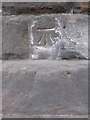
1GL bench mark and bolt on Chester Road railway bridge
This First Geodetic Levelling bench mark dates to the 1851-1852 Warrington to Pembroke Docks survey. It is mark number 41 on that line. For more details of the mark see the Bench mark database http://www.bench-marks.org.uk/bm31215
Image: © John S Turner
Taken: 8 Mar 2010
0.04 miles