IMAGES TAKEN NEAR TO
Whitehall Place, FRODSHAM, WA6 6PL
Introduction
This page details the photographs taken nearby to Whitehall Place, WA6 6PL by members of the Geograph project.
The Geograph project started in 2005 with the aim of publishing, organising and preserving representative images for every square kilometre of Great Britain, Ireland and the Isle of Man.

There are currently over 7.5m images from over14,400 individuals and you can help contribute to the project by visiting https://www.geograph.org.uk
Image Map
Images are licensed for reuse under creativecommons.org/licenses/by-sa/2.0
Notes
- Clicking on the map will re-center to the selected point.
- The higher the marker number, the further away the image location is from the centre of the postcode.
Image Listing (134 Images Found)
Images are licensed for reuse under creativecommons.org/licenses/by-sa/2.0
Image
Details
Distance
2

Cut Mark: #82 Church Street, Frodsham
OS Cut Mark on the sandstone roadside wall outside #82 Church Street, Frodsham. Number B10992 on the Benchmark Database, see http://www.bench-marks.org.uk/bm37338
Image: © VBForever
Taken: 18 Mar 2011
0.04 miles
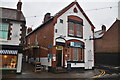
9

Phone Box/Post Box/Stamp Machine
Unusual combined 'Post Office' with three services in one
Image: © sue hayton
Taken: 17 Feb 2003
0.09 miles