IMAGES TAKEN NEAR TO
Hastings Drive, WA6 0GH
Introduction
This page details the photographs taken nearby to Hastings Drive, WA6 0GH by members of the Geograph project.
The Geograph project started in 2005 with the aim of publishing, organising and preserving representative images for every square kilometre of Great Britain, Ireland and the Isle of Man.

There are currently over 7.5m images from over14,400 individuals and you can help contribute to the project by visiting https://www.geograph.org.uk
Image Map
Images are licensed for reuse under creativecommons.org/licenses/by-sa/2.0
Notes
- Clicking on the map will re-center to the selected point.
- The higher the marker number, the further away the image location is from the centre of the postcode.
Image Listing (15 Images Found)
Images are licensed for reuse under creativecommons.org/licenses/by-sa/2.0
Image
Details
Distance
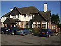
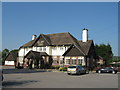
3
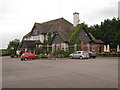
Helsby Arms
The Helsby Arms at the side of the A56.
Image: © David Dixon
Taken: 5 Jun 2012
0.11 miles
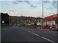
4
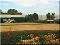
Helsby Sports and Social Club
On the A56 at Helsby, and overlooked by Helsby Hill
Image: © Roger May
Taken: 11 Aug 2005
0.12 miles
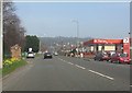
7
Chester Road (A56)
Chester Road, approaching Helsby.
Image: © David Dixon
Taken: 9 Nov 2010
0.14 miles

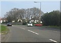
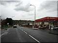
10
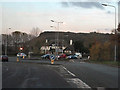
Warrington Road (A56)
The A56, Warrington Road, approaching its junction with the A5117, near Helsby. The Helsby Arms is on the other side of the junction.
Image: © David Dixon
Taken: 9 Nov 2010
0.17 miles