IMAGES TAKEN NEAR TO
Haley Road North, WARRINGTON, WA5 4JD
Introduction
This page details the photographs taken nearby to Haley Road North, WA5 4JD by members of the Geograph project.
The Geograph project started in 2005 with the aim of publishing, organising and preserving representative images for every square kilometre of Great Britain, Ireland and the Isle of Man.

There are currently over 7.5m images from over14,400 individuals and you can help contribute to the project by visiting https://www.geograph.org.uk
Image Map
Images are licensed for reuse under creativecommons.org/licenses/by-sa/2.0
Notes
- Clicking on the map will re-center to the selected point.
- The higher the marker number, the further away the image location is from the centre of the postcode.
Image Listing (13 Images Found)
Images are licensed for reuse under creativecommons.org/licenses/by-sa/2.0
Image
Details
Distance
6
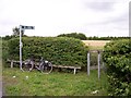
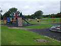
Public footpath to recreation area off Gorsey Lane
Image: © Raymond Knapman
Taken: 23 Jul 2010
0.14 miles
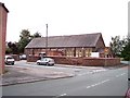
7
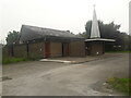
St Paul of the Cross Roman Catholic Church
Built 2001. Architects Cassidy & Ashton.
Image: © S Parish
Taken: 12 Sep 2021
0.16 miles
9
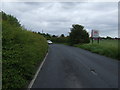
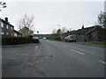
A bend in Gorsey Lane
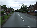
Heading east into Burtonwood.
Image: © JThomas
Taken: 5 Jun 2014
0.18 miles
10
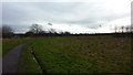
Cotton Tails Nursery at Burtonwood
Image: © Raymond Knapman
Taken: 23 Jul 2010
0.19 miles