IMAGES TAKEN NEAR TO
Alder Lane, WARRINGTON, WA5 4BL
Introduction
This page details the photographs taken nearby to Alder Lane, WA5 4BL by members of the Geograph project.
The Geograph project started in 2005 with the aim of publishing, organising and preserving representative images for every square kilometre of Great Britain, Ireland and the Isle of Man.

There are currently over 7.5m images from over14,400 individuals and you can help contribute to the project by visiting https://www.geograph.org.uk
Image Map
Images are licensed for reuse under creativecommons.org/licenses/by-sa/2.0
Notes
- Clicking on the map will re-center to the selected point.
- The higher the marker number, the further away the image location is from the centre of the postcode.
Image Listing (11 Images Found)
Images are licensed for reuse under creativecommons.org/licenses/by-sa/2.0
Image
Details
Distance
1
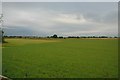
Farm land near Burtonwood.
This is a view looking south west from Old Alder Lane (somewhere between Burtonwood and Winwick) across farm land. In the distance can be seen the ever present Fiddlers Ferry power station.
Image: © andy
Taken: 25 Jul 2005
0.06 miles
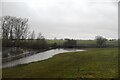
2
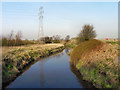
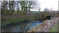
Sankey Brook
Looking upstream from Causey West Bridge
Image: © David Dixon
Taken: 24 Mar 2012
0.17 miles
3
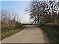
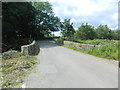
Old Alder Lane
Old Alder Lane, near Causey West Bridge.
Image: © David Dixon
Taken: 24 Mar 2012
0.19 miles
4
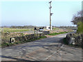
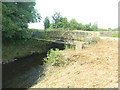
Causey West Bridge
Old Alder Lane crossing Sankey Brook.
Image: © David Dixon
Taken: 24 Mar 2012
0.19 miles
6
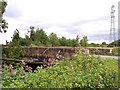
Causey West Bridge
The single span masonry arch bridge carries a minor road (Old Alder Lane) over Sankey Brook. An Environment Agency monitoring station is nearby behind the photographer.
Image: © Richard Cooke
Taken: 28 Dec 2013
0.20 miles
7
Causey West Bridge, Newton le Willows
Bridge over the Sankey Brook
Image: © John Lord
Taken: 23 Jul 2012
0.20 miles
10
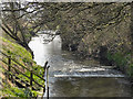
Sankey Brook
Looking downstream from Causey West Bridge.
Image: © David Dixon
Taken: 24 Mar 2012
0.22 miles