IMAGES TAKEN NEAR TO
Barkers Hollow Road, WARRINGTON, WA4 4LW

Introduction

This page details the photographs taken nearby to Barkers Hollow Road, WA4 4LW by members of the Geograph project.

The Geograph project started in 2005 with the aim of publishing, organising and preserving representative images for every square kilometre of Great Britain, Ireland and the Isle of Man.

There are currently over 7.5m images from over14,400 individuals and you can help contribute to the project by visiting https://www.geograph.org.uk

Image Map


Images are licensed for reuse under creativecommons.org/licenses/by-sa/2.0
Notes
  • Clicking on the map will re-center to the selected point.
  • The higher the marker number, the further away the image location is from the centre of the postcode.

Image Listing (14 Images Found)

Images are licensed for reuse under creativecommons.org/licenses/by-sa/2.0
Image
Details
Distance
1
Barker's Hollow Road
Image: © Ian Greig Taken: 22 Jan 2016
0.15 miles
2
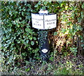
Trent & Mersey Canal Milepost at Preston Brook
This milepost is near the north portal of the Preston Brook Tunnel, which marks one end of the Trent & Mersey Canal, it is the last milepost on the canal. The Trent and Mersey Canal is a 93.5-mile long canal (150.5 km), it begins at Derwent Mouth, where it meets the River Trent and the River Derwent. Image, for the milepost at the Derwent Mouth end of the canal. Image, for the previous milepost along the canal.
Image: © Mat Fascione Taken: 15 Jul 2015
0.22 miles
3
Tunnel Top North, Trent & Mersey Canal
Image: © Ian S Taken: 29 Jan 2022
0.22 miles
4
Bridgewater canal at Preston Brook Tunnel
This is the start of the Trent & Mersey canal, only 92 miles to Shardlow.
Image: © Ian S Taken: 29 Jan 2022
0.22 miles
5
Mile post zero on the Trent & Mersey canal
Image: © Ian S Taken: 29 Jan 2022
0.22 miles
6
Preston Brook Tunnel, Cheshire
This canal tunnel at the southern end of the Bridgewater Canal link is 1239 yards (1133 metres) in length, is only wide enough for a narrowboat, and is not quite straight. There is no towpath, so horses were led across the hill to the other end. Before steam and diesel engined boats, the men legged the vessels though the tunnel. The south portal is shown in this image. 10 metres into the tunnel the waterway transforms into the Trent and Mersey canal Canal. North bound boats enter the tunnel on the hour until ten minutes past. South bound boats enter the tunnel at half past the hour, until forty minutes past. It takes about twenty minutes to take a narrowboat through the tunnel.
Image: © Roger D Kidd Taken: 29 Aug 2011
0.23 miles
7
Preston Brook Tunnel, Cheshire
This canal tunnel at the southern end of the Bridgewater Canal link is 1239 yards (1133 metres) in length, is only wide enough for a narrowboat, and is not quite straight. There is no towpath, so horses were led across the hill to the other end. Before steam and diesel engined boats, the men legged the vessels though the tunnel. The north portal is shown in this image. 10 metres into the tunnel the waterway transforms into the Trent and Mersey canal Canal. A one way system operates: north bound boats enter the tunnel on the hour until ten minutes past. South bound boats enter the tunnel at half past the hour, until forty minutes past. It takes about twenty minutes to take a narrowboat through the tunnel.
Image: © Roger D Kidd Taken: 29 Aug 2011
0.23 miles
8
The northern portal of Preston Brook Tunnel
This is the northern end of the Trent and Mersey canal and the start of the Bridgewater canal. The tunnel is too narrow for two boats to pass so a one-way system is in operation.
Image: © Ray Folwell Taken: 9 Sep 2008
0.23 miles
9
Trent & Mersey Canal Milepost at Preston Brook
Image: © Mat Fascione Taken: 15 Jul 2015
0.23 miles
10
Northern end of Preston Brook Tunnel
Image: © John Slater Taken: 29 Nov 2014
0.23 miles