IMAGES TAKEN NEAR TO
Broseley Place, WARRINGTON, WA3 4HS

Introduction

This page details the photographs taken nearby to Broseley Place, WA3 4HS by members of the Geograph project.

The Geograph project started in 2005 with the aim of publishing, organising and preserving representative images for every square kilometre of Great Britain, Ireland and the Isle of Man.

There are currently over 7.5m images from over14,400 individuals and you can help contribute to the project by visiting https://www.geograph.org.uk

Image Map


Images are licensed for reuse under creativecommons.org/licenses/by-sa/2.0
Notes
  • Clicking on the map will re-center to the selected point.
  • The higher the marker number, the further away the image location is from the centre of the postcode.

Image Listing (17 Images Found)

Images are licensed for reuse under creativecommons.org/licenses/by-sa/2.0
Image
Details
Distance
1
Broseley Bridge
Broseley Lane crossing the railway at Broseley Bridge
Image: © David Dixon Taken: 24 Mar 2012
0.01 miles
2
Broseley Lane and bridge over the railway
Image: © Steve Fareham Taken: 10 Apr 2012
0.01 miles
3
Broseley Bridge
Image: © Anthony Parkes Taken: 24 Oct 2011
0.01 miles
4
B5207 bridge over the Liverpool & Manchester Railway
Image: © David Long Taken: 3 Jan 2009
0.02 miles
5
Broseley Lane railway bridge
Image: © Ian Greig Taken: 4 Oct 2011
0.02 miles
6
Railway running east from Broseley Bridge
Image: © JThomas Taken: 2 Mar 2013
0.04 miles
7
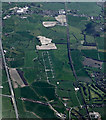
Glazebury explosives depot from the air
A former ICI storage depot between Leigh and Culcheth, now owned by Orica, a mining services company http://www.oricaminingservices.com/gb/en . Viewed from a Manchester bound flight from Prague.
Image: © Thomas Nugent Taken: 18 Apr 2014
0.04 miles
8
Broseley Lane (B5207)
Heading south.
Image: © JThomas Taken: 2 Mar 2013
0.07 miles
9
Farmland towards the railway
Image: © JThomas Taken: 2 Mar 2013
0.08 miles
10
From Broseley Lane railway bridge
Image: © Ian Greig Taken: 4 Oct 2011
0.09 miles