IMAGES TAKEN NEAR TO
Broughton Avenue, WARRINGTON, WA3 2PU
Introduction
This page details the photographs taken nearby to Broughton Avenue, WA3 2PU by members of the Geograph project.
The Geograph project started in 2005 with the aim of publishing, organising and preserving representative images for every square kilometre of Great Britain, Ireland and the Isle of Man.

There are currently over 7.5m images from over14,400 individuals and you can help contribute to the project by visiting https://www.geograph.org.uk
Image Map
Images are licensed for reuse under creativecommons.org/licenses/by-sa/2.0
Notes
- Clicking on the map will re-center to the selected point.
- The higher the marker number, the further away the image location is from the centre of the postcode.
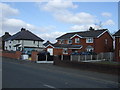
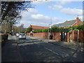
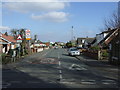
Image Listing (8 Images Found)
Images are licensed for reuse under creativecommons.org/licenses/by-sa/2.0
Image
Details
Distance
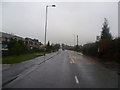
1
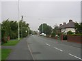
Church Lane
Looking in a northwesterly direction along Church Lane, Lowton. SJ61849739.
Image: © Keith Williamson
Taken: 12 Sep 2005
0.09 miles

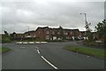
8
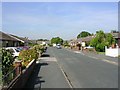
Thornbury Avenue, Lowton
Looking in a northerly direction along this avenue which typifies the development in this area during the second half of the Twentieth Century. SJ62369731.
Image: © Keith Williamson
Taken: 12 Sep 2005
0.24 miles