IMAGES TAKEN NEAR TO
Lynwood Avenue, WARRINGTON, WA3 1HJ
Introduction
This page details the photographs taken nearby to Lynwood Avenue, WA3 1HJ by members of the Geograph project.
The Geograph project started in 2005 with the aim of publishing, organising and preserving representative images for every square kilometre of Great Britain, Ireland and the Isle of Man.

There are currently over 7.5m images from over14,400 individuals and you can help contribute to the project by visiting https://www.geograph.org.uk
Image Map
Images are licensed for reuse under creativecommons.org/licenses/by-sa/2.0
Notes
- Clicking on the map will re-center to the selected point.
- The higher the marker number, the further away the image location is from the centre of the postcode.
Image Listing (37 Images Found)
Images are licensed for reuse under creativecommons.org/licenses/by-sa/2.0
Image
Details
Distance
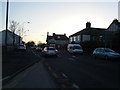
2
The A580, East Lancashire Road from Church Lane
Image: © Ian S
Taken: 18 Jul 2012
0.10 miles
4
The A580, East Lancashire Road from Church Lane
Image: © Ian S
Taken: 18 Jul 2012
0.11 miles
7
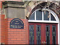
Lane Head Methodist Church
Plaque at entrance to the church.
Image: © Mike Tonge
Taken: 23 Jan 2011
0.12 miles
8
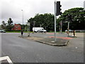
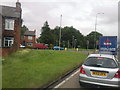
Ready, steady - go!
Traffic lights at Lane Head junction.
Image: © David Long
Taken: 3 Jan 2009
0.12 miles
10
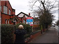
Lane Head Methodist Church
My attention was drawn to the SOLD sign and the wording underneath. I thought all churches had the ability to convert!!
Image: © Mike Tonge
Taken: 23 Jan 2011
0.13 miles