IMAGES TAKEN NEAR TO
Back Lane, KNUTSFORD, WA16 9SG
Introduction
This page details the photographs taken nearby to Back Lane, WA16 9SG by members of the Geograph project.
The Geograph project started in 2005 with the aim of publishing, organising and preserving representative images for every square kilometre of Great Britain, Ireland and the Isle of Man.

There are currently over 7.5m images from over14,400 individuals and you can help contribute to the project by visiting https://www.geograph.org.uk
Image Map
Images are licensed for reuse under creativecommons.org/licenses/by-sa/2.0
Notes
- Clicking on the map will re-center to the selected point.
- The higher the marker number, the further away the image location is from the centre of the postcode.
Image Listing (20 Images Found)
Images are licensed for reuse under creativecommons.org/licenses/by-sa/2.0
Image
Details
Distance
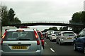
1
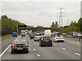
Footbridge over Northbound M6, Lower Peover
Image: © David Dixon
Taken: 17 May 2013
0.07 miles
3
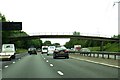
Footbridge over the M6
Heading north on the M6.
Image: © Steve Daniels
Taken: 17 Jun 2015
0.08 miles
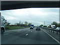
4
Footpath crossing near The Fields Farm
M6 south
Image: © John Firth
Taken: 20 May 2014
0.08 miles
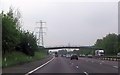
5
A footbridge crosses the M6 near Lower Peover
Image: © Steve Daniels
Taken: 20 Sep 2013
0.09 miles
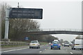
6

M6 Motorway near The Field farm
The farm's accommodation bridge is visible beyond the power lines.
Image: © Peter Whatley
Taken: 21 Jan 2011
0.09 miles
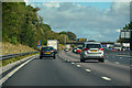
7
M6 southbound from under The Fields Farm bridge
Image: © Colin Pyle
Taken: 7 Apr 2011
0.09 miles
8
Nether Peover : M6 Motorway
The M6 Motorway between Junction 18 and Junction 19.
Image: © Lewis Clarke
Taken: 23 Sep 2019
0.12 miles
9
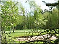
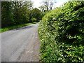
Peover Golf Club bunker
Seen though the hedgerow from back Lane, which won't be possible in a couple of weeks.
Image: © Christine Johnstone
Taken: 13 May 2012
0.15 miles
10
Back Lane, from the passing place
Looking south, towards the entrance to The Fields Farm.
Image: © Christine Johnstone
Taken: 13 May 2012
0.16 miles