IMAGES TAKEN NEAR TO
Plumley Moor Road, KNUTSFORD, WA16 9RS
Introduction
This page details the photographs taken nearby to Plumley Moor Road, WA16 9RS by members of the Geograph project.
The Geograph project started in 2005 with the aim of publishing, organising and preserving representative images for every square kilometre of Great Britain, Ireland and the Isle of Man.

There are currently over 7.5m images from over14,400 individuals and you can help contribute to the project by visiting https://www.geograph.org.uk
Image Map
Images are licensed for reuse under creativecommons.org/licenses/by-sa/2.0
Notes
- Clicking on the map will re-center to the selected point.
- The higher the marker number, the further away the image location is from the centre of the postcode.
Image Listing (24 Images Found)
Images are licensed for reuse under creativecommons.org/licenses/by-sa/2.0
Image
Details
Distance
3
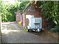
Telephone Exchange, Plumley
Situated in Pinfold Lane, this redbrick TE used to take the name Lower Peover and has the code MRLOW. It serves 970 residential and 113 non-residential premises in Lower Peover, Plumley, Smithy Green, Swan Green and the surrounding rural area. A portable generator can be seen in front of this TE, which can be recognised by the square white BT warning notice and the yellow grit salt bin in the photo. This TE is one of six TEs in the Knutsford group and has the numbering range (01565) 722xxx. Its postcode is WA16 9RR.
Image: © David Hillas
Taken: 25 Jul 2017
0.14 miles
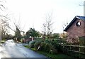
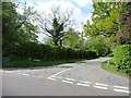
4
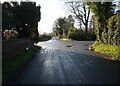
Left for Lower Peover, right for Lach Dennis
Junction of Trouthall and Back Lanes, with a difficult-to-read road sign.
Image: © Christine Johnstone
Taken: 13 May 2012
0.16 miles
5
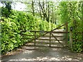
Entrance to Orchard Cottage, Plumley Moor
On the east side of Back Lane.
Image: © Christine Johnstone
Taken: 13 May 2012
0.17 miles
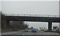
8
Northbound M6, Bridge at Plumley Moor Road
Image: © David Dixon
Taken: 17 May 2013
0.19 miles
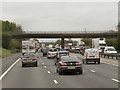
9
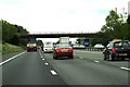
Plumley Moor Road crosses the M6
Heading north on the M6.
Image: © Steve Daniels
Taken: 17 Jun 2015
0.19 miles
10
Location of 34 metre spot height, Trouthall Lane
Seen from the junction with Back Lane.
Image: © Christine Johnstone
Taken: 13 May 2012
0.20 miles