IMAGES TAKEN NEAR TO
Marthall Lane, KNUTSFORD, WA16 8RR
Introduction
This page details the photographs taken nearby to Marthall Lane, WA16 8RR by members of the Geograph project.
The Geograph project started in 2005 with the aim of publishing, organising and preserving representative images for every square kilometre of Great Britain, Ireland and the Isle of Man.

There are currently over 7.5m images from over14,400 individuals and you can help contribute to the project by visiting https://www.geograph.org.uk
Image Map
Images are licensed for reuse under creativecommons.org/licenses/by-sa/2.0
Notes
- Clicking on the map will re-center to the selected point.
- The higher the marker number, the further away the image location is from the centre of the postcode.
Image Listing (8 Images Found)
Images are licensed for reuse under creativecommons.org/licenses/by-sa/2.0
Image
Details
Distance
1
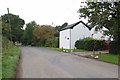
Marthall Lane at Pear Tree Farm
Approaching the village of Ollerton
Image: © Glyn Baker
Taken: 21 Sep 2013
0.02 miles
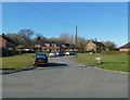
2
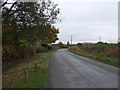
Marthall Lane
Heading north east from Ollerton.
Image: © JThomas
Taken: 29 Oct 2016
0.04 miles
4
Pear Tree Farm, Marthall Lane, Ollerton
Image: © Anthony O'Neil
Taken: 22 Mar 2011
0.05 miles
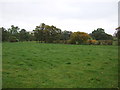
5
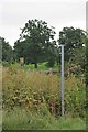
Footpath to Brookhouse Farm
This footpath links Marthall Lane and Chelford Rd
Image: © Glyn Baker
Taken: 21 Sep 2013
0.06 miles
7
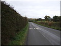
Marthall Lane near Meadowland Farm
Looking east.
Image: © JThomas
Taken: 29 Oct 2016
0.18 miles
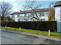
8
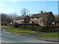
Houses on Marthall Lane, Ollerton, Cheshire
Image: © Anthony O'Neil
Taken: 22 Mar 2011
0.18 miles